 Skopje
 occupies a broad basin along the Vardar River in North Macedonia’s Skopje Region. Mount Vodno rises immediately south of the centre, giving the capital a close mountain edge while its neighbourhoods extend across the valley floor. The city developed near Roman Scupi and later became an important Ottoman provincial centre; its Old Bazaar preserves mosques, hans and craft workshops from that era. The Stone Bridge, built under Ottoman rule in the 15th century, crosses the Vardar between the old commercial quarter and Macedonia Square. Skopje was radically reshaped after the 1963 earthquake, making its mix of Ottoman fabric, modernist planning and newer monuments especially distinctive.
Generated by AI






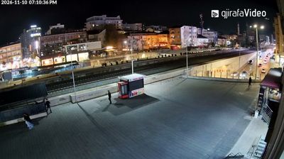


The landscape around Skopje is a broad valley along the Vardar River, which has shaped both the urban form and local economy. The capital of North Macedonia spreads across the river’s banks, with Mount Vodno rising to the south and the Skopje Fortress overlooking the historic core. The Old Bazaar preserves a dense network of Ottoman-era streets, mosques, inns and workshops, while the Stone Bridge links it with Macedonia Square. A devastating earthquake in 1963 transformed much of the city and influenced its subsequent rebuilding. Explore nearby webcam locations that provide complementary perspectives on Skopje and the Vardar Valley.
3 webcams
The Vardar River defines much of the City of Skopje - its broad valley has long concentrated North Macedonia’s government, commerce, transport and urban life. The capital extends between Mount Vodno to the south and the Skopska Crna Gora range to the north, giving its dense centre a distinctly basin-like setting. The Stone Bridge links the modern central districts with the Ottoman-era Old Bazaar, while Skopje Fortress stands above the older quarter. Rebuilt and reshaped after the devastating 1963 earthquake, Skopje combines layers of Balkan, Ottoman and modern civic architecture. Move on to other webcams in the region to compare riverfront, urban and mountain-framed settings around Skopje.
3 webcams
The Vardar River valley defines much of North Macedonia — its route through the country has concentrated farms, roads and major towns between mountain ranges. Lake Ohrid, shared with Albania, gives the southwest a different character: an ancient lake beside the historic city of Ohrid and its UNESCO-listed natural and cultural heritage. Skopje, the capital, combines the Ottoman-era Old Bazaar with newer districts on both sides of the Vardar. Elsewhere, the Šar Mountains, Mavrovo National Park and the Pelister range frame a compact country of highland pastures, forests and agricultural basins. Food traditions draw on Balkan and Mediterranean influences, with peppers, beans and local wines prominent. Move on to other webcams in the region to compare landscapes and settings around North Macedonia.
19 webcams