 Gorno Sonje: Krstovar
Krstovar combines wooded mountain terrain with the nearby capital’s urban basin in a way that reflects its position on Vodno Mountain above Skopje. It is the highest point of Vodno, a long ridge rising immediately south of North Macedonia’s capital, and a popular destination for local walks and mountain recreation. The Millennium Cross, erected here in 2002, makes the summit a prominent landmark over the Skopje Basin. Below, the slopes descend through woodland toward settlements including Gorno Sonje, while the wider basin places Vodno between the city and the surrounding Balkan uplands. Its ridge forms one of Skopje’s most immediate mountain horizons.
Generated by AI

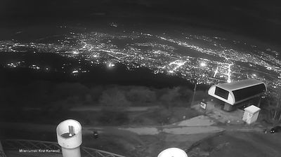








Gorno Sonje straddles the lower southern slopes of Vodno Mountain in the Skopje Region, a position that places this small settlement between Skopje’s urban basin and the rural terrain of the municipality of Sopište. Vodno forms a long, forested ridge above the capital, while its southern side leads towards rolling hills and scattered villages. The Millennium Cross on Vodno’s summit is among the region’s most recognisable modern landmarks, connecting the mountain with Skopje’s skyline and public life. Gorno Sonje is a useful point of reference for discovering the quieter mountain-edge communities close to North Macedonia’s largest city. Continue with other webcams from the area to see how this part of the Skopje Region connects regionally.
2 webcams
Municipality of Sopishte occupies the southern fringe of the Skopje Basin in North Macedonia. It lies just southwest of the capital, where settled farmland and villages meet the lower slopes of Mount Vodno. This is a largely rural municipality, shaped by its close connection to Skopje while retaining a quieter foothill character. Near the municipality, the Church of St. Panteleimon in Nerezi is renowned for its 12th-century Byzantine frescoes, a major landmark of medieval Macedonian art. Explore nearby webcams to place Sopishte between Mount Vodno and the wider Skopje area.
2 webcams
The Vardar River valley defines much of North Macedonia — its route through the country has concentrated farms, roads and major towns between mountain ranges. Lake Ohrid, shared with Albania, gives the southwest a different character: an ancient lake beside the historic city of Ohrid and its UNESCO-listed natural and cultural heritage. Skopje, the capital, combines the Ottoman-era Old Bazaar with newer districts on both sides of the Vardar. Elsewhere, the Šar Mountains, Mavrovo National Park and the Pelister range frame a compact country of highland pastures, forests and agricultural basins. Food traditions draw on Balkan and Mediterranean influences, with peppers, beans and local wines prominent. Move on to other webcams in the region to compare landscapes and settings around North Macedonia.
19 webcams