 Bima: Jalan Pantai Ule - Jalan Karantina
Bima combines the bustle of an eastern Sumbawa port with the slower rhythm of a coastal Indonesian city in a way that reflects its position on Bima Bay. Jalan Karantina and Jalan Pantai Ule are part of the street network around Ule, a coastal quarter on the city’s southeastern side. Bima was the seat of the Bima Sultanate; its former palace, Asi Mbojo, is preserved as a museum. The city is also associated with tenun Bima, a local tradition of handwoven cloth. Its bay-facing setting has long connected urban life to maritime trade, while the wider island of Sumbawa gives Bima a distinct eastern Indonesian character.
Generated by AI
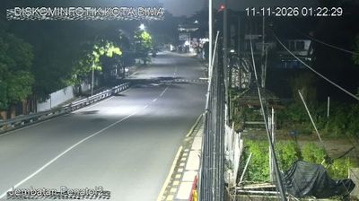


Tucked along Bima Bay on the eastern coast of Sumbawa, Bima is a place whose character is shaped by a sheltered inlet facing the Flores Sea. The city is a regional centre and port in an island region marked by a pronounced dry season and volcanic terrain. The former Sultanate of Bima remains central to local identity; Asi Mbojo, the sultan’s former palace, holds collections connected with the court and Mbojo heritage. Bima is also known in Indonesia for woven songket textiles, whose intricate motifs and ceremonial role keep a longstanding craft tradition present in daily community life. Browse additional webcams nearby to better understand how Bima Bay and eastern Sumbawa relate to their surroundings.
5 webcams
The terrain of West Nusa Tenggara ranges from Lombok’s volcanic slopes in the west to Sumbawa’s drier hills and long coastlines in the east, creating a province shaped by islands and sea passages. The Alas Strait separates its two main islands, while Mount Rinjani rises over northern Lombok and Mount Tambora marks eastern Sumbawa. Tambora’s 1815 eruption ranks among the most powerful volcanic events in recorded history. Sasak communities are central to Lombok’s identity, while Sumbawa has its own Samawa traditions. Coral-fringed shores, farming districts and volcanic country give the province distinctly varied local character. Continue with other webcams from the area to see how this part of West Nusa Tenggara connects regionally.
5 webcams
Indonesia has served as a maritime crossroads between the Indian and Pacific oceans since the early centuries of international trade. Its vast archipelago stretches across the equator, linking the volcanoes and rice-growing plains of Java with the rainforests of Borneo and the coral-fringed islands of eastern Indonesia. Java is home to Borobudur, a ninth-century Buddhist temple complex and UNESCO World Heritage Site, while Bali’s Hindu traditions shape daily ceremonies and temple life. Bahasa Indonesia provides a shared national language alongside hundreds of local languages. The Java Sea, Banda Sea and busy straits have long connected islands, ports and cuisines. Browse other webcams across Indonesia’s islands to place this setting in a wider geographic context.
599 webcams