 Molo
Built around a railway station, Molo grew into an agricultural town in Nakuru County. It stands in Kenya’s Rift Valley highlands, close to the eastern side of the Mau Forest complex, the country’s largest closed-canopy forest ecosystem. Cultivated fields, grazing land and belts of trees shape the surrounding countryside, underscoring the importance of farming here. The railway through Molo forms part of the historic line linking Nakuru with Kisumu, while the wider Mau region is closely tied to Kenya’s water catchments. Forest conservation and land use in Mau remain nationally important issues, giving this working highland town a direct connection to one of Kenya’s key environmental landscapes.
Generated by AI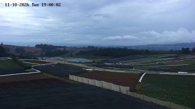
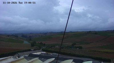


Molo lies along the Molo River in Nakuru County, where cultivated highlands meet the extensive Mau Forest complex. The town belongs to Kenya’s cool central Rift Valley uplands, a working landscape shaped by smallholdings, dairy farming and potato cultivation rather than the savannah often associated with the country. Mau Forest is a major regional water catchment, and the Molo River flows onward toward Lake Nakuru. Molo also stands on the road and rail corridor between Nakuru and western Kenya, giving its centre an important everyday role in the region. Continue with other webcams from the area to see how this part of Nakuru County connects regionally.
4 webcams
Nakuru combines fertile highland agriculture with volcanic Rift Valley terrain in a way that reflects its position within Kenya’s Great Rift Valley. The county extends from the Mau Forest complex across escarpments and open farming country toward Lake Nakuru, whose alkaline waters support large numbers of waterbirds. Lake Nakuru National Park is also known for protected rhino populations, while the nearby Menengai Crater recalls the area’s volcanic formation. Nakuru city grew as a railway centre in the early twentieth century and remains an important commercial hub for surrounding farms. View additional webcams nearby to better understand how Nakuru relates to the Rift Valley’s lakes, forests, and highlands.
12 webcams
The Great Rift Valley and the Indian Ocean coastline define much of Kenya — their contrasts support farming, fishing, trade and tourism. Nairobi is a major commercial centre in East Africa and home to Nairobi National Park, where wildlife moves close to the city. Maasai Mara National Reserve is known for the annual migration of wildebeest and zebra from Tanzania’s Serengeti. Near the equator rises Mount Kenya, the country’s highest mountain; its protected area is a UNESCO World Heritage site. Swahili culture is especially evident on the coast, including in Lamu Old Town, a UNESCO-listed settlement shaped by centuries of Indian Ocean trade. Find related webcams in the surrounding area to build a fuller picture of Kenya.
68 webcams