 Itapoa
Itapoá lies along Brazil’s Atlantic coast in northern Santa Catarina, where a low, sandy shoreline carries beaches and residential districts near the Paraná state border. The municipality faces the open South Atlantic, while the more sheltered Babitonga Bay lies farther south around São Francisco do Sul. Itapoá was established as an independent municipality in 1989 after separating from Garuva. It has developed as a residential and holiday town, with long beaches shaping its coastal neighbourhoods. Its position between São Francisco do Sul and Paraná’s coast places it in a southern Brazilian region shaped by seaside tourism, port activity and expanding coastal settlement.
Generated by AI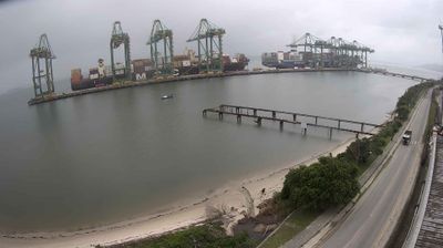
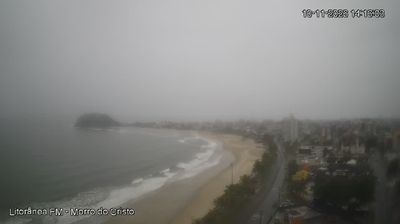

Built around settlements on Santa Catarina’s northern Atlantic coast, Itapoá grew into a coastal municipality shaped by beaches, lagoons and the waters near Babitonga Bay. It lies close to the border with Paraná, where a long sandy shoreline meets a low-lying coastal plain backed by Atlantic Forest remnants. The Port of Itapoá, opened in 2011, has made the municipality an important point in southern Brazil’s container-shipping network, adding a working maritime dimension to its holiday-resort character. Beaches such as Itapema do Norte and Pontal do Norte are central to local life, especially during the Brazilian summer. Browse additional views from the surrounding area to extend your view of northern Santa Catarina.
2 webcams
Atlantic coastline, remnants of the Atlantic Forest and southern highlands define much of Santa Catarina — their contrasting environments support agriculture, manufacturing, port trade and tourism. Brazil’s southern state stretches from Atlantic beaches to cooler upland areas, where Araucaria forest is an important regional feature. Florianópolis, the state capital, occupies Santa Catarina Island and is closely associated with the coast, while the interior has long been shaped by farming and industry. Azorean traditions remain visible in coastal communities, and German and Italian immigration has strongly influenced food, architecture and local festivals in other parts of the state. Browse additional webcams around Santa Catarina to extend your view of southern Brazil.
14 webcams
Brazil has served as a Portuguese colonial link between Europe and South America since the 16th century. Its immense territory extends from the Amazon River basin in the north to the Atlantic coast, with the Pantanal wetlands and Brazilian Highlands creating very different regions inland. Rio de Janeiro sits beside Guanabara Bay beneath Sugarloaf Mountain, while Brasília is known for its planned layout and modernist buildings by Oscar Niemeyer. Portuguese is the official language, and football, regional cuisines and Carnival celebrations are central to public life across the country. Continue through nearby webcams to explore different parts of Brazil.
145 webcams