 Ólafsvík: Arnarstapi Harbour
Few places on Iceland’s Snæfellsnes Peninsula have a history as closely tied to fishing and maritime trade as Arnarstapi. This small settlement on the peninsula’s south coast developed as a trading post and remains centred on its sheltered harbour. The North Atlantic has cut the nearby shore into dark basalt cliffs, coves and sea stacks, while Mount Stapafell rises immediately inland. Arnarstapi lies near Snæfellsjökull, the glacier-capped volcano that gives the peninsula much of its identity. A sculpture of Bárður Snæfellsás, the half-troll guardian from Icelandic folklore, links the harbour settlement to the region’s sagas.
Generated by AI




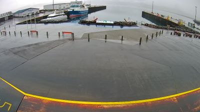

Ólafsvík blends the working rhythm of a fishing harbour with the exposed calm of Iceland’s west coast, reflecting its position on the northern shore of the Snæfellsnes Peninsula. The town faces Breiðafjörður, the broad bay separating Snæfellsnes from the Westfjords, while the glacier-capped volcano Snæfellsjökull rises farther west on the peninsula. Fishing has shaped local life for generations, and the harbour remains central to the settlement’s identity. Ólafsvík is part of Snæfellsbær municipality, whose communities follow the peninsula’s coastal route. Explore additional webcams nearby to understand how Ólafsvík relates to Breiðafjörður and the wider Snæfellsnes coast.
12 webcams
Glacial rivers, lava fields and the shores of Borgarfjörður shape much of Iceland’s Western Region, sustaining sheep farms, fishing communities and travel along the Ring Road. The region stretches from the Snæfellsnes Peninsula, crowned by the glacier-capped Snæfellsjökull volcano, to fertile valleys and geothermal sites inland. Reykholt is closely associated with Snorri Sturluson, the medieval Icelandic writer and chieftain, while Deildartunguhver is one of Europe’s most powerful hot springs. Borgarnes and Akranes provide urban links between rural districts and the capital area. See how Western Region fits into western Iceland by browsing webcams nearby.
34 webcams
Iceland occupies a volcanic North Atlantic island on the Mid-Atlantic Ridge, between Europe and North America. Glaciers, black-sand shores and active geothermal areas form a terrain in constant dialogue with the weather; Vatnajökull is Europe’s largest glacier by volume. The Golden Circle links Þingvellir National Park, the Geysir geothermal area and Gullfoss waterfall, while Reykjavík concentrates much of the country’s contemporary culture and design. At Þingvellir, the Alþingi first assembled in 930. Fishing, wool knitwear and geothermal energy remain central to Icelandic life. Find related webcams in the surrounding area to build a fuller picture of Iceland.
628 webcams