 Szczawno-Zdroj: Trójgarb 778 m n.p.m. z wieżą widokową
The Wałbrzych Mountains define the setting of Szczawno-Zdrój — wooded ridges and broad, rolling foothills give this Lower Silesian spa town a distinctly upland character. Trójgarb, at 778 metres, is the highest summit of the range and is named for its three humps; a 2018 observation tower stands on its summit. Szczawno-Zdrój developed as a health resort around mineral waters and retains the formal Spa Park and historic treatment buildings associated with that tradition. The town lies beside Wałbrzych, near Poland’s border with Czechia, where walking routes extend through the forested hills. Trójgarb’s tower links the resort’s landscaped core with the wider terrain of the Sudetes.
Generated by AI




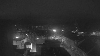


Few towns in Lower Silesia have a history as closely tied to therapeutic mineral springs as Szczawno-Zdrój. In the foothills of the Sudetes beside Wałbrzych, this established health resort is known for acidic mineral waters, reflected in its Polish name. Once called Bad Salzbrunn under Prussian and later German rule, it developed around spa treatment and retains a formal spa park, promenade buildings and 19th-century resort architecture. Szczawno-Zdrój still has the compact, leafy character of a Polish uzdrowisko, where treatment facilities remain part of daily town life. Discover other points of interest through webcams located across Szczawno-Zdrój and Lower Silesia.
5 webcams
Among the regions of Poland, Lower Silesian Voivodeship stands out for the meeting of the Sudetes, the Oder valley and historic Wrocław. Its southern edge reaches the Karkonosze range, where Śnieżka rises as the highest peak of the Sudetes, while broad lowlands and river corridors shape the north. Wrocław is the regional centre, known for its Market Square, the cathedral district of Ostrów Tumski and the UNESCO-listed Centennial Hall. Further west, Książ Castle near Wałbrzych recalls the area’s long Silesian past. Browse additional webcams around the region to extend your view of Lower Silesia.
72 webcams
Poland stretches from the Baltic Sea coast in the north to the Carpathian Mountains along its southern frontier, encompassing broad lowlands, lake districts and upland ranges. The Vistula, the country’s longest river, links Kraków and Warsaw before reaching the Baltic near Gdańsk, while the Masurian Lake District is defined by a dense network of lakes. Kraków’s historic centre, including Wawel Castle, recalls Poland’s former royal capital; Warsaw’s rebuilt Old Town speaks to the city’s recovery after the Second World War. The Białowieża Forest preserves one of Europe’s last primeval lowland forests and is home to European bison. Follow how Poland’s regions relate to one another by browsing webcams across the country.
709 webcams