 Mareeba: Gorge Creek Orchards
Gorge Creek Orchards lies along Gorge Creek on the Atherton Tablelands west of Mareeba, where cultivated land extends across an elevated inland plain edged by low ranges. This part of Far North Queensland is a productive farming district, with irrigated properties growing crops including mangoes, citrus and avocados alongside grazing land. Mareeba developed as a service town for the Tablelands and remains an important centre for surrounding rural communities. Its name comes from an Aboriginal expression commonly translated as “meeting of the waters”, referring to the district’s waterways. The Coral Sea coast lies well to the east of this inland landscape of savanna, farmland and volcanic soils.
Generated by AI

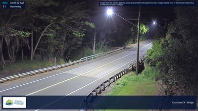

Mareeba combines an open, dry tableland setting with tropical agriculture, reflecting its position on the western side of Queensland’s Atherton Tablelands. The Barron River runs nearby, as the cooler and wetter uplands begin to give way towards the savanna country of the interior. Coffee, mangoes, bananas and sugarcane are grown across the surrounding district, while the annual Mareeba Rodeo reflects its enduring rural character. The town is also a useful stop on routes between Cairns, Kuranda and the wider tablelands. Continue with other webcams around the Atherton Tablelands to see how this part of Queensland connects the coast and inland.
5 webcams
Queensland extends from Torres Strait in the north to the New South Wales border in the south, encompassing a tropical coastline and a vast, dry interior. Along the Coral Sea, the Great Barrier Reef runs beside the state’s eastern shore, while inland plains, grazing country and long distances define much of central and western Queensland. This location lies in the interior, where settlements are widely spaced and open outback horizons contrast with the humid coast. Queensland is home to Aboriginal and Torres Strait Islander peoples, whose enduring connections to Country underpin its cultural identity. Browse additional webcams from central Queensland to extend your view of the state’s interior.
474 webcams
Australia’s terrain extends from tropical rainforests in the northeast to arid plains in the interior, producing dramatic climatic contrasts. The Great Dividing Range follows much of the eastern coast, while the Great Barrier Reef lies off Queensland in the Coral Sea and Uluru rises from the central desert. Aboriginal and Torres Strait Islander peoples maintain living cultures whose connections to Country long predate European settlement. In Sydney, the sail-like Opera House, completed in 1973, stands beside one of the world’s best-known harbours. Discover further points of interest through webcams located across Australia.
1.6K webcams