 Yuzhno-Sakhalinsk
 is best known in Sakhalin Oblast for serving as its administrative centre. It lies in the Susuya River valley, enclosed by the Susunai Range on Sakhalin Island, where broad streets and Soviet-era districts meet newer commercial development. From 1905 to 1945 it was the Japanese city of Toyohara, a period recalled by the Sakhalin Regional Museum, housed in a building completed in 1937 for the Karafuto Prefectural Museum. Today, it is the island’s largest city and a practical base for Gorny Vozdukh, a ski area on the city’s edge, as well as for exploring Sakhalin’s Russian, Korean and Japanese influences.
Generated by AI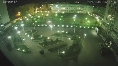

Yuzhno-Sakhalinsk occupies the Susuya River valley in southern Sakhalin Oblast, on Sakhalin Island in Russia’s Far East. The low slopes of the Susunai Range rise east of the city, while its districts spread across a broad inland basin rather than the island’s rugged coast. From 1905 to 1945, it was the administrative centre of Japanese Karafuto and known as Toyohara. That period is recalled by the Sakhalin Regional Museum, housed in a 1937 building constructed for the Karafuto Prefectural Museum. As Sakhalin’s main administrative and transport centre, the city brings together many of the island’s Russian, Korean and Japanese cultural connections. Continue through nearby webcams to explore different parts of Yuzhno-Sakhalinsk and Sakhalin Island.
2 webcams
Sakhalin Oblast occupies an island arc in Russia’s Far East. Its territory includes Sakhalin, Russia’s largest island, and the Kuril chain, which extends south from Kamchatka into the Pacific. Sakhalin lies between the Sea of Okhotsk and the Sea of Japan; its interior is mountainous and forested, while the shores face two very different seas. Yuzhno-Sakhalinsk is the administrative centre, and the region reflects the long presence of Indigenous Nivkh communities alongside Russian, Japanese and Korean connections. Fishing and energy extraction remain central to the economy, amid long winters with heavy snow. Explore nearby webcam locations that provide complementary perspectives on Sakhalin Oblast.
2 webcams
Russia has served as a major power between Europe and Asia since the 16th century. Its territory crosses eleven time zones, extending from the Baltic coast and the East European Plain over the Ural Mountains to the Pacific. The Volga, Europe’s longest river, runs through a core of historic Russian settlement, while Lake Baikal in Siberia is the world’s deepest lake. Moscow’s Kremlin and Red Square stand at the centre of the capital’s political and architectural heritage; Saint Petersburg’s Hermitage Museum occupies the Winter Palace. Orthodox churches, Russian-language literature, ballet and long-distance rail travel remain familiar reference points in a country of immense regional contrasts. Continue with other webcams from Russia to see how this part of northern Eurasia connects regionally.
456 webcams