 Białystok: Białystok
Lipowy Most sits in the Knyszyn Forest in Poland’s Podlaskie Voivodeship, where a broad belt of woodland, clearings and wetlands extends across the country’s north-east. The settlement lies in the area of the Knyszyn Forest Landscape Park, a protected expanse of mainly pine and spruce woods, peatlands and small watercourses. The forest gives the area a secluded character despite its proximity to Białystok. It also preserves the legacy of former royal hunting grounds associated with the Polish-Lithuanian state. Lipowy Most is known for its golf course among the trees, while the wider forest provides space for low-key outdoor recreation and nature study.
Generated by AI



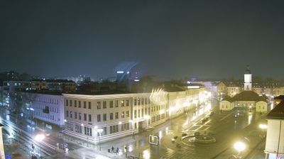

Białystok is best known within Poland for the 18th-century Branicki Palace and its formal gardens. The Biała River runs through this major city of northeastern Poland, the regional centre of Podlaskie Voivodeship. The palace, once the residence of the powerful Branicki family, now forms part of the Medical University of Białystok. Białystok was also the birthplace of Ludwik Zamenhof, creator of Esperanto, reflecting the city’s historically diverse Polish, Jewish, Belarusian and other communities. Browse other webcams across Podlaskie Voivodeship to place Białystok in a wider geographic context.
8 webcams
Built around the Narew and Bug river systems, Podlaskie Voivodeship grew into Poland’s northeastern borderland, where lowlands meet extensive forests and wetlands. The Biebrza marshes, protected in Biebrza National Park, are among the region’s defining habitats, while the Narew flows through a network of channels and floodplain meadows. Białowieża Forest, shared with Belarus and inscribed on UNESCO’s World Heritage List, preserves one of Europe’s last large remnants of primeval lowland forest and its European bison. Białystok is the regional capital, and Podlaskie also carries the heritage of Poland’s Lipka Tatars, notably in Kruszyniany and Bohoniki. Trace this northeastern Polish region’s place in the wider borderland by browsing webcams nearby.
25 webcams
Poland stretches from the Baltic Sea coast in the north to the Carpathian Mountains along its southern frontier, encompassing broad lowlands, lake districts and upland ranges. The Vistula, the country’s longest river, links Kraków and Warsaw before reaching the Baltic near Gdańsk, while the Masurian Lake District is defined by a dense network of lakes. Kraków’s historic centre, including Wawel Castle, recalls Poland’s former royal capital; Warsaw’s rebuilt Old Town speaks to the city’s recovery after the Second World War. The Białowieża Forest preserves one of Europe’s last primeval lowland forests and is home to European bison. Follow how Poland’s regions relate to one another by browsing webcams across the country.
716 webcams