 Banket
Mazvikadei Dam spans the Mukwadzi River in Zimbabwe’s Mashonaland West, creating a reservoir that has made water management central to the rural area around Banket. Completed in 1988, the dam is an important piece of infrastructure for irrigation and water supply, set among the low, rugged hills of the Zimbabwean Highveld. The Mukwadzi belongs to the wider Manyame River catchment, whose waters ultimately run north towards the Zambezi. Banket, to the west, developed as a mining settlement, while the dam has added a markedly different presence to the district: a long body of water edged by rocky slopes and cultivated land. Mazvikadei is valued as a working reservoir rather than an urban landmark, linking engineering, farming and the region’s river system.
Generated by AI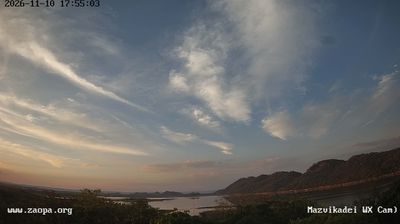

Tucked along Zimbabwe’s Great Dyke in Mashonaland West, Banket is a town whose character is shaped by the mineral-bearing geology of this long north–south ridge. The settlement stands on the main road between Harare and the country’s north, in a farming and mining district of the Zimbabwean Highveld. Gold mining has long been part of Banket’s local story, while the surrounding countryside reflects Mashonaland West’s agricultural economy. Banket is a practical stop rather than a monument-filled destination, with everyday town life linked to the road, nearby farms and extractive industries. Explore additional webcams nearby to understand how Banket relates to the wider Mashonaland West landscape.
1 webcam
Mashonaland West combines broad farming country with the rugged Zambezi escarpment in a way that reflects its position between Zimbabwe’s central plateau and the northern border with Zambia. The province reaches Lake Kariba, the vast reservoir created by the Kariba Dam on the Zambezi River, where shorelines and islands mark a sharp change from the interior’s fields and woodland. Chinhoyi, the provincial capital, is known for the Chinhoyi Caves, whose deep blue pool is a major local landmark. Tobacco and maize cultivation remain important to the regional economy, while smaller towns link rural districts to Harare. Explore nearby webcam locations that provide complementary perspectives on Mashonaland West’s plateau, lake country and Zambezi frontier.
2 webcams
Zimbabwe occupies a landlocked position in southern Africa. The Zambezi River forms much of its northern frontier, and Victoria Falls, where the river drops into the Batoka Gorge, is among the country’s defining landmarks. Granite outcrops and open grassland in Matobo National Park contrast with the forested slopes of the Eastern Highlands near Mozambique. Great Zimbabwe’s dry-stone walls mark a medieval urban centre that gave the modern nation its name, and the site is listed by UNESCO. Wildlife reserves, including Hwange National Park, are central to Zimbabwe’s identity, while Harare is its capital and largest city. See how Zimbabwe fits within southern Africa by browsing webcams nearby.
22 webcams