 Santa-Lucia-di-Moriani
The Tyrrhenian Sea defines the setting of Santa-Lucia-di-Moriani — this settlement occupies Corsica’s eastern coastal strip, with the island’s mountainous interior rising inland behind it. Homes, gardens and local roads spread across the lower ground, giving the area a more residential character than a dense town centre. Inland lies Castagniccia, a forested Corsican region long associated with chestnut cultivation and hill villages. The coast faces Italy across the Tyrrhenian Sea, while the steep relief behind Santa-Lucia-di-Moriani reflects the close meeting of shore, cultivated land and mountain country that marks much of eastern Corsica.
Generated by AI
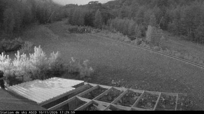

Santa-Lucia-di-Moriani sits on the Tyrrhenian Sea along Corsica’s eastern coast in France, where the island’s coastal plain meets its first wooded foothills. The commune includes the seaside area of Moriani-Plage, while the T10, Corsica’s principal north–south coastal route, links it with Bastia and other settlements along the shore. Inland, the terrain turns rapidly more rural and mountainous, reflecting the marked contrast between Corsica’s beach-lined east and its rugged interior. French is the official language, and Corsican remains an important part of the island’s cultural identity. View additional webcams nearby to better understand how Santa-Lucia-di-Moriani relates to Corsica’s eastern coastline and interior.
1 webcam
Built around Mediterranean sea routes and mountain communities, Corsica grew into a distinctive French island with a strong regional identity. Its terrain rises abruptly from the coast to the granite summits of the central mountains, crowned by Monte Cinto, the island’s highest peak. The long-distance GR 20 crosses this rugged spine, while beaches and sheltered coves line much of the shore. Ajaccio, on the west coast, is the birthplace of Napoleon Bonaparte; elsewhere, the Corsican language, polyphonic singing and local food traditions reflect ties to both France and the wider Mediterranean. Find related webcams across Corsica and nearby shores to build a fuller picture of this Mediterranean island.
18 webcams
The Atlantic and Mediterranean coastlines, together with the Alps, Pyrenees and broad river basins, define much of France — they support maritime trade, farming, wine regions and travel throughout the year. The Seine runs through Paris, where the Eiffel Tower and the Louvre are among Europe’s most recognised landmarks. The Loire Valley is known for Renaissance châteaux, while Mont-Saint-Michel rises from a tidal bay in Normandy. Regional food traditions are equally distinctive, from Breton seafood to Provençal cooking, with bread, cheese and wine central to everyday life. France’s global cultural influence is evident in its language, literature, fashion and cinema. View additional webcams nearby to better understand how France’s coasts, plains and mountain borders relate to their surroundings.
2.2K webcams