 Balgonie
 has served as a railway settlement in southeastern Saskatchewan since the 1880s. Set on the open plains of the Canadian Prairies, it grew along the Canadian Pacific Railway corridor and remains closely tied to the farm country east of Regina. The town’s name was taken from Balgonie in Fife, Scotland, recalling the Scottish place-names brought to the prairie by early settlers. Highway 46 meets the Trans-Canada Highway near the community, linking it with Regina and the rural southeast. Grain production and other prairie agriculture shape the surrounding land, while homes, local services and railway-era roots give Balgonie a distinctly small-town Saskatchewan identity. Long, straight roads and rail lines cross cultivated fields beneath the broad prairie horizon.
Generated by AI

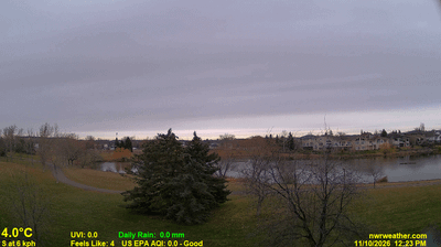

Balgonie lies along the Wascana Creek valley, where Saskatchewan’s broad, cultivated prairie extends east of Regina. The town sits on the Trans-Canada Highway and is part of the province’s long-established agricultural belt, with open fields and big skies defining the surrounding countryside. Balgonie developed as a railway settlement in the late 19th century, a history reflected in its role as a small service centre for nearby rural communities. Its location also makes it a practical stop between Regina and the Qu’Appelle Valley. Explore nearby webcam locations that provide complementary perspectives on Balgonie and southeastern Saskatchewan.
3 webcams
Saskatchewan stretches from the United States border to the 60th parallel at the Northwest Territories, encompassing southern grain-growing plains and the boreal forest and Canadian Shield of the north. The South Saskatchewan River crosses the settled south, including Saskatoon, while the Churchill River runs through a northern country of lakes, rock and conifers. Regina, the provincial capital, is home to the Saskatchewan Legislative Building, completed in 1912. First Nations and Métis communities remain central to the province’s identity; Cree, Dene, Saulteaux and Métis traditions reflect both prairie and northern cultures. Move on to other webcams in the region to compare landscapes and settings around Saskatchewan.
62 webcams
Canada has served as a frontier between French and British colonial powers since the 17th century. The world’s second-largest country extends from Atlantic shores to the Pacific and Arctic coasts, with the Canadian Shield, the Rocky Mountains, the Great Lakes and the St. Lawrence River shaping its vast geography. First Nations, Inuit and Métis peoples are central to Canada’s identity, while Ottawa’s Parliament Hill represents its federal political life. French remains the official language of Quebec, adding a distinct dimension to the country’s public culture. See how Canada connects across North America by browsing webcams in neighbouring regions.
3.5K webcams