 District of Trebišov: Stanča
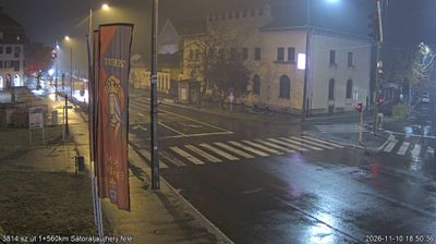
The Slanské vrchy define the setting of Stanča — this small eastern Slovak settlement extends across cultivated land and gardens at the foothills of the range. Stanča belongs to the Trebišov District in the Košice Region, where lowland farming communities meet the wooded slopes of the volcanic Slanské vrchy. Detached homes, fruit trees and fields give the village a clearly rural pattern, while its church tower forms a local architectural landmark. Rather than an urban centre, Stanča represents the settled agricultural edge of eastern Slovakia and its gradual transition towards the hills.
Generated by AI





The District of Trebišov is best known within the Košice Region for Slovakia’s share of the Tokaj wine region. Its southern lowlands are crossed by the Latorica River, whose floodplain is protected as the Latorica Protected Landscape Area; vineyards around Čerhov, Malá Tŕňa and Veľká Tŕňa belong to the historic Tokaj landscape shared with Hungary. In the district town of Trebišov, the ruins of medieval Parič Castle and the Andrássy family mausoleum add a historical layer to this agricultural part of eastern Slovakia. Find related webcams in the surrounding area to build a fuller picture of the Trebišov District and the Košice Region.
3 webcams
The Region of Košice combines the urban energy of Slovakia’s second-largest city with the broad, quieter landscapes of the east in a way that reflects its position between the Slovak Ore Mountains and the lowlands near Hungary. Košice is centred on Hlavná ulica, where St Elisabeth Cathedral forms the Gothic focal point of the historic core. Beyond the city, the Hornád River crosses a region of wooded hills, farmland and karst terrain. Slovak Karst National Park, known for its extensive cave systems, adds a distinct geological dimension to this corner of Slovakia. Browse additional webcams from the surrounding area to extend your view of eastern Slovakia.
26 webcams
Slovakia is best known internationally for the High Tatras, whose granite summits form the country’s most celebrated mountain landscape. Gerlachovský štít, at 2,655 metres, is the highest peak in Slovakia and in the Carpathians. The Danube runs past Bratislava, where Bratislava Castle stands on a hill above the river, linking the capital to Central Europe’s major waterway. Beyond the cities, forests, karst terrain and small historic towns define much of the country. Slovakia’s long folk tradition is also represented by the fujara, a large shepherd’s flute recognised by UNESCO. Browse additional webcams from the surrounding area to extend your view of the High Tatras and the Danube region.
282 webcams