 Richmond: I-295 Mile 49 SB
The landscape around Richmond is gently rolling and heavily wooded, which has shaped both the built environment and local life. Richmond lies along the Kennebec River in central Maine, where forested banks and low hills frame a small town with a long connection to river transport. During the 19th century, local shipyards built wooden sailing vessels, contributing to the Kennebec’s shipbuilding economy. Swan Island lies in the river near Richmond and is managed as a wildlife management area. Interstate 295 passes through the town’s wider area, linking this river community with the Portland region and the state-capital area. Richmond combines a working transport corridor with the quieter scale of the Kennebec valley.
Generated by AI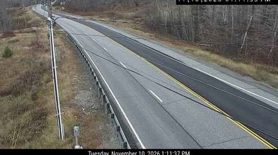






Richmond sits on the Kennebec River in Maine, United States, where tidal water continues north from Merrymeeting Bay. The compact town developed along a waterway once central to Maine’s shipbuilding and river trade, and its older civic and residential streets retain a distinctly 19th-century scale. Across the river, Swan Island is a state wildlife management area of woods, fields and shoreline, reached seasonally by ferry from Richmond. The Kennebec links the town southward with Bath and the Atlantic estuary, while inland roads lead through Maine’s rural river country. Browse additional webcams from the surrounding area to extend your view of the Kennebec River valley.
5 webcams
Atlantic coastline and extensive northern forests define much of Maine - fishing ports, boatbuilding communities and the forest-products industry have long shaped the state’s economy and identity. The Gulf of Maine cuts into a rugged shore of islands, peninsulas and tidal inlets, while the Penobscot River runs from the interior toward Penobscot Bay. Inland, Baxter State Park contains Mount Katahdin, the northern terminus of the Appalachian Trail. Acadia National Park on Mount Desert Island protects granite headlands and coastal woodland. Maritime traditions remain tangible in Maine’s lobster fishery, and Portland Head Light, completed in 1791, stands near Portland as a historic beacon. Browse additional webcams from the surrounding area to extend your view of Maine.
431 webcams
The Atlantic, Pacific and Gulf coasts define much of the United States — their ports, fisheries and trade routes have long tied the country’s economy to the wider world. Between them, the Rocky Mountains, Great Plains and Mississippi River basin form sharply different regions, from high western ranges to broad agricultural heartlands. Cities carry much of the national story: New York’s Statue of Liberty, a gift from France dedicated in 1886, remains an enduring symbol, while Washington, DC concentrates major federal institutions. Indigenous nations have shaped these lands for millennia, and their living cultures remain essential to the country’s identity. Find related webcams in the surrounding areas to build a fuller picture of the United States.
32K webcams