 Beaufort: Taylor Creek - Lenoxville Point
Lenoxville Point sits on Taylor Creek in coastal North Carolina, where a tidal channel runs beside Beaufort’s waterfront and low salt marshes of the Crystal Coast. The creek belongs to the sheltered waterway network around Beaufort, a port town established in 1709. Its waterfront has long linked the community with fishing, boating and the waters around the nearby barrier islands. Docks and private slips line the shore at Lenoxville Point, while marsh grasses and wooded edges retain the area’s coastal character. Beaufort’s historic district preserves early homes and a maritime tradition that remains closely tied to Taylor Creek.
Generated by AI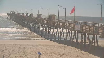

Beaufort lies along Taylor’s Creek on North Carolina’s coast, where sheltered waters helped shape a long-standing port and seafaring community. Across the creek, Carrot Island is part of the Rachel Carson Reserve, a protected estuarine area inhabited by wild horses and shorebirds. Beaufort’s historic district preserves streets and houses connected to its maritime past, while the North Carolina Maritime Museum explores regional boatbuilding and the nearby wreck of Blackbeard’s Queen Anne’s Revenge. Boats also leave from town for Shackleford Banks and Cape Lookout National Seashore. Explore nearby webcam locations that provide complementary perspectives on Beaufort and North Carolina’s Crystal Coast.
1 webcam
Among the regions of the United States, North Carolina stands out for its sweep from the Blue Ridge Mountains across the Piedmont to the Atlantic’s barrier islands. The coordinates lie in the central Piedmont, where rolling, wooded terrain and growing communities link the mountain country with the coastal plain. To the west, the Blue Ridge Parkway follows the Appalachian highlands; eastward, the Outer Banks form a long sandy edge facing the Atlantic. North Carolina holds an enduring place in aviation history: the Wright brothers made the first successful powered flight near Kitty Hawk in 1903. Barbecue traditions and university towns add further character to this state of distinct regions. Discover North Carolina in its wider Southeastern setting by browsing webcams in nearby areas.
58 webcams
The Atlantic, Pacific and Gulf coasts define much of the United States — their ports, fisheries and trade routes have long tied the country’s economy to the wider world. Between them, the Rocky Mountains, Great Plains and Mississippi River basin form sharply different regions, from high western ranges to broad agricultural heartlands. Cities carry much of the national story: New York’s Statue of Liberty, a gift from France dedicated in 1886, remains an enduring symbol, while Washington, DC concentrates major federal institutions. Indigenous nations have shaped these lands for millennia, and their living cultures remain essential to the country’s identity. Find related webcams in the surrounding areas to build a fuller picture of the United States.
32K webcams