 Providenciales: Long Bay Beach
Among the beaches of Providenciales, Long Bay Beach stands out for its shallow, open water along the Caicos Banks. The broad sandy shore occupies the island’s southeastern coast, where low coastal vegetation and villas meet the sea. Its long, uncluttered stretch is closely associated with kiteboarding, one of the outdoor activities for which Providenciales is known. The beach lies away from the main concentration of large resorts on Grace Bay, giving this side of the island a more residential coastal character. Providenciales is the territory’s most populous island, while the Turks and Caicos Islands are a British Overseas Territory. Long Bay Beach brings together the Caicos Banks’ shallow shelf and the settled shoreline of eastern Providenciales.
Generated by AI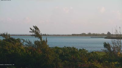

Among the settlements of Providenciales, Providenciales stands out for Grace Bay, a long crescent of beach along the island’s north coast. The bay lies within Princess Alexandra National Park, where coral reefs and seagrass beds form part of a protected marine environment. Low limestone ground, salt ponds and mangrove wetlands give the island a different character away from the resort strip; the channels around Leeward are an important part of this coastal setting. Conch is central to local cooking, appearing in salads, fritters and cracked-conch dishes, while the Thursday Fish Fry at Bight Park brings people together around island food and music. Explore additional webcams nearby to better understand how Providenciales relates to its surrounding reefs and cays.
2 webcams
The terrain of Providenciales ranges from low limestone ridges in the island’s interior to sandy shores and tidal wetlands along its northern and southern edges, creating a compact setting of dry scrub, lagoons and reef-fringed water. Grace Bay runs along the northeast coast, facing an extensive offshore reef, while Chalk Sound National Park protects a vivid lagoon dotted with small limestone cays. The Lucayan people lived across the Turks and Caicos Islands before European arrival, and conch remains a defining ingredient in local cooking. Browse other webcams across the Turks and Caicos Islands to place Providenciales in a wider geographic context.
2 webcams
The terrain of the Turks and Caicos Islands ranges from low limestone plateaus on Grand Turk to mangrove wetlands on Middle Caicos, leaving much of the archipelago low-lying and closely tied to the sea. Set southeast of the Bahamas, this British Overseas Territory comprises the larger Caicos Islands and the smaller Turks Islands, separated by the Turks Island Passage. Grace Bay on Providenciales is known for its long beach and reef-protected water, while the Caicos Banks form a vast shallow marine platform. Salt production once shaped life on Grand Turk and Salt Cay; remnants of salinas recall that trade. Place the islands in their wider Atlantic setting by browsing webcams nearby.
2 webcams