 uMgeni Local Municipality: Umgeni Valley Nature Reserve
Umgeni Valley Nature Reserve combines wooded river gorges with open, rolling Midlands grassland in a way that reflects its position along the uMngeni River. Near Howick in KwaZulu-Natal, the reserve protects a section of the river valley where slopes, thickets and grassland meet. The uMngeni rises in the KwaZulu-Natal Midlands and continues east to the Indian Ocean; at nearby Howick it forms Howick Falls. This part of the Midlands is also associated with the Midlands Meander, a touring route connecting craft workshops, farm shops and places to eat. The reserve gives the inland landscape a more untamed counterpoint to the settled gardens and smallholdings around it.
Generated by AI
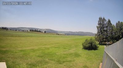

Tucked along the uMngeni River in the KwaZulu-Natal Midlands, uMgeni Local Municipality is an area whose character is shaped by rolling uplands, farming country and summer rainfall. Howick, its administrative centre, stands near Howick Falls, where the river drops about 95 metres into a gorge. The area also carries national historical weight: the Nelson Mandela Capture Site marks the vicinity where Mandela was arrested in 1962, before his long imprisonment. Country roads link small towns, farms and craft stops associated with the Midlands Meander, while Karkloof’s wooded hills add another dimension to the interior. See how uMgeni Local Municipality fits within the KwaZulu-Natal Midlands by browsing webcams nearby.
2 webcams
KwaZulu-Natal occupies South Africa’s eastern coastal belt and adjoining interior uplands. Its long Indian Ocean shoreline gives way to sugar-cane country, river valleys and the Drakensberg, whose escarpment marks much of the province’s western edge. The uKhahlamba-Drakensberg Park is recognised for its mountain terrain and extensive San rock-art heritage, while iSimangaliso Wetland Park protects lakes, wetlands and coastal ecosystems in the northeast. Durban, the province’s largest city and a major port, reflects the area’s African, Indian and colonial histories. Explore nearby webcam locations that provide complementary perspectives on KwaZulu-Natal.
10 webcams
The terrain of South Africa ranges from coastal lowlands along the Indian Ocean in the east to high inland plateaus across the centre, producing marked regional climate contrasts. The Drakensberg forms a rugged eastern escarpment, while Atlantic and Indian Ocean shores frame cities including Cape Town and Durban. Table Mountain stands above Cape Town, and the Cape Floristic Region is internationally noted for its exceptional plant diversity. South Africa’s modern identity is inseparable from apartheid and the democratic transition of 1994, a history explored at Johannesburg’s Apartheid Museum. Twelve official languages reflect the country’s diverse communities. Continue through nearby webcams to explore different parts of South Africa.
62 webcams