 Cajetina Municipality
The landscape around Tornik is a highland of grassy slopes and pine woods, which has shaped both the built environment and local life. At 1,496 metres, Tornik is the highest summit of Zlatibor Mountain in western Serbia, part of the Dinaric mountain system. Its open slopes and forest margins are used by the Tornik ski centre, while Zlatibor's broad uplands have long supported grazing. The region is also known for its food traditions, particularly smoked beef and dairy products. At Sirogojno, the open-air museum preserves wooden houses and farm buildings that document rural life in this part of Serbia. Tornik brings Zlatibor's recreational infrastructure into a setting still defined by pasture, conifer woodland and wide mountain ridges.
Generated by AI

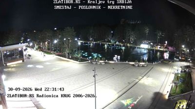

Few municipalities in Central Serbia have a history as closely tied to highland pastoral life as Cajetina Municipality. It encompasses much of Zlatibor, a broad mountain region of meadows, pine woodland and scattered hamlets, with Tornik rising as its highest summit. Zlatibor developed from a summer grazing area into one of Serbia’s best-known mountain resorts, while rural traditions remain visible beyond its busy centre. In nearby Sirogojno, the Old Village Museum preserves traditional wooden houses and household buildings from the Zlatibor area. Move on to other webcams in Central Serbia to compare mountain settings around Zlatibor.
3 webcams
Among Serbia’s regions, Central Serbia stands out for the rolling hills of Šumadija and the broad river corridors that lead towards the Velika Morava. This is the country’s geographic core, where cultivated lowlands, wooded uplands and market towns form a transition between the Pannonian Plain and Serbia’s southern mountains. Kragujevac, the historic centre of Šumadija, became the capital of the Principality of Serbia under Miloš Obrenović and remains an important industrial and cultural city. The region also includes the fertile Morava valley, a long-established route for travel and settlement. Discover how Central Serbia connects with the surrounding Serbian regions by browsing webcams nearby.
44 webcams
Serbia is best known internationally for its tennis champion Novak Djokovic, winner of 24 Grand Slam singles titles. The Danube crosses the country before meeting the Sava in Belgrade, where Belgrade Fortress occupies a long-defended position above the confluence. North of the capital, the Vojvodina plain contrasts with the wooded hills and river gorges of central and eastern Serbia, including the Đerdap section of the Danube along the Romanian border. Novi Sad is known for Petrovaradin Fortress and the EXIT music festival, while Serbian Orthodox monasteries remain central to the country’s religious heritage. Browse other webcams across Serbia and the Balkans to place this setting in a wider geographic context.
53 webcams