 Waremme
Tucked into the gently rolling Hesbaye plateau, Waremme is a place whose character is shaped by fertile loess soils and the intensive farming they support. This Walloon town stands in Belgium’s broad central belt of open fields, where grain, sugar beet and other crops have long structured the surrounding land. Its built-up core combines closely set homes, local services and mature tree cover rather than grand monuments. Waremme belongs to French-speaking Wallonia, while the Dutch name Borgworm reflects the linguistic borderland to the north. Its position between Liège and Brussels has made it a practical regional centre, with rail links reinforcing connections to larger cities.
Generated by AI

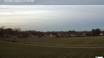



Waremme occupies a broad, cultivated stretch of the Hesbaye plateau in eastern Wallonia. Near the town, the Geer flows north as a tributary of the Meuse, crossing a region of deep loess soils long used for cereal and sugar-beet farming. Known in Dutch as Borgworm, Waremme is a French-speaking regional centre between Liège and Brussels. Its station lies on the main railway route linking those two cities, reinforcing the town’s role within Belgium’s densely connected heartland. The surrounding fields give Waremme a distinctly Hesbaye identity, away from the industrial character of much of the Meuse valley. Browse other webcams across Wallonia to place this setting in a wider geographic context.
1 webcam
Among Belgium’s regions, Wallonia stands out for its French-speaking identity and the Meuse and Sambre valleys that helped shape the country’s industrial age. The Meuse runs through a chain of historic towns, including Namur, where the Sambre joins it beneath the city’s citadel, and Dinant, the birthplace of saxophone inventor Adolphe Sax. South and east, the terrain rises into the Ardennes, with forests, river valleys and smaller settlements replacing the denser urban belt. Wallonia’s towns still reflect long traditions of mining, metalworking and river trade, while abbey brewing remains part of the regional culture. Browse additional webcams from the surrounding area to extend your view of Wallonia.
47 webcams
Belgium occupies a low-lying North Sea coastline and river plain in northwestern Europe. Dutch-speaking Flanders lies largely to the north, while French-speaking Wallonia reaches south towards the wooded Ardennes; Brussels is officially bilingual. The Scheldt and Meuse have long connected Belgian cities with the North Sea and continental Europe. Brussels’ Grand-Place, framed by ornate guildhalls and the Town Hall, is a UNESCO World Heritage site. Medieval Bruges retains canals and merchant architecture, while Antwerp remains a major port on the Scheldt. Belgian beer culture is recognised by UNESCO as intangible cultural heritage. See how Belgium connects with the North Sea coast and neighbouring regions by browsing webcams nearby.
99 webcams