 Finch Hatton: Owens Creek Loop Road
Finch Hatton has served as a rural settlement in Queensland’s Pioneer Valley since the late nineteenth century. Owens Creek Loop Road runs through the district’s lowland river country, where a bridge carries local traffic across a broad, tree-lined watercourse. The Pioneer River is the defining river of the valley, descending from ranges west of Mackay before reaching the Coral Sea. Sugar-cane farming has long shaped the Pioneer Valley’s settlement pattern and economy, while Finch Hatton is also a starting point for the forested country around Eungella National Park. This practical corner of tropical Queensland is defined by road links, river crossings and the transition from coastal plain to upland rainforest.
Generated by AI
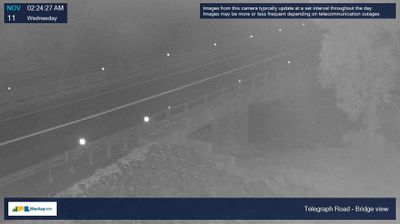


Finch Hatton sits in the Pioneer Valley in Queensland, Australia, where the Clarke Range rises west of Mackay and rainforest begins beyond the cane fields. This small settlement is closely tied to the valley’s agricultural country, a major sugar-growing area shaped by a wet tropical climate. Nearby Eungella National Park protects upland rainforest and walking country around Finch Hatton Gorge, where creeks and falls contrast with the cultivated lowlands. The road toward Eungella climbs from the valley into the range, connecting Finch Hatton with one of central Queensland’s best-known rainforest areas. View additional webcams nearby to better understand how Finch Hatton and the Pioneer Valley relate to the Clarke Range.
1 webcam
Queensland extends from Torres Strait in the north to the New South Wales border in the south, encompassing a tropical coastline and a vast, dry interior. Along the Coral Sea, the Great Barrier Reef runs beside the state’s eastern shore, while inland plains, grazing country and long distances define much of central and western Queensland. This location lies in the interior, where settlements are widely spaced and open outback horizons contrast with the humid coast. Queensland is home to Aboriginal and Torres Strait Islander peoples, whose enduring connections to Country underpin its cultural identity. Browse additional webcams from central Queensland to extend your view of the state’s interior.
469 webcams
Australia’s terrain extends from tropical rainforests in the northeast to arid plains in the interior, producing dramatic climatic contrasts. The Great Dividing Range follows much of the eastern coast, while the Great Barrier Reef lies off Queensland in the Coral Sea and Uluru rises from the central desert. Aboriginal and Torres Strait Islander peoples maintain living cultures whose connections to Country long predate European settlement. In Sydney, the sail-like Opera House, completed in 1973, stands beside one of the world’s best-known harbours. Discover further points of interest through webcams located across Australia.
1.5K webcams