 Mima
The landscape around Mima is shaped by the broad Yoshino River floodplain and low, wooded hills, which have shaped both the built environment and local life. This western Tokushima city extends along the river valley, where levees, farmland and small settlements follow the flatter ground. The Yoshino, one of Shikoku’s principal rivers, has long provided a water source and a corridor through the island. Mima’s best-known historic quarter is Wakimachi Udatsu, where Edo-period merchant houses feature udatsu firewalls, raised roof-edge partitions that also signalled commercial success. The district developed through the indigo trade, closely associated with Tokushima. Beyond its preserved streets, Mima retains the rural character of a settled river valley framed by the Shikoku Mountains.
Generated by AI
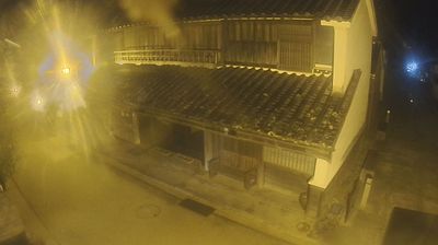


Among the cities of Tokushima Prefecture, Mima stands out for the Udatsu Townscape in its Waki district, a preserved street of Edo-period merchant houses. The city lies beside the Yoshino River, whose broad valley has long shaped settlement and agriculture in central Shikoku. Waki prospered through the indigo trade, and many old stores retain udatsu: raised plastered partitions designed to limit the spread of fire between buildings. Their distinctive rooflines recall the wealth generated by a trade that connected this inland town with wider Japanese markets. Find related webcams across the Yoshino River valley to build a fuller picture of Mima and Tokushima Prefecture.
4 webcams
Among Japan’s regions, Tokushima Prefecture stands out for the Yoshino River, whose broad lower reaches meet the Kii Channel near Tokushima City. Occupying eastern Shikoku, the prefecture extends from this river plain to a rugged interior and a Pacific-facing coast. At the Naruto Strait, powerful tidal currents create the famous Naruto whirlpools between Shikoku and Awaji Island. Tokushima’s best-known tradition is Awa Odori, an August dance festival in the prefectural capital, when organised groups fill the streets with music and movement. The former province of Awa also gave its name to a local indigo-dyeing tradition. Continue with other webcams from the area to trace how eastern Shikoku connects with the Kii Channel and Japan’s Inland Sea.
32 webcams
Among the countries of East Asia, Japan stands out for its volcanic archipelago, stretching from the cool north of Hokkaido to subtropical Okinawa. Mount Fuji, the nation’s highest mountain, rises above central Honshu, while the Pacific Ocean and the Seto Inland Sea have long shaped settlement, fishing and travel. Tokyo pairs dense urban life with major museums and neighbourhood traditions; Kyoto preserves temples, gardens and the legacy of Japan’s imperial court. Seasonal customs give journeys a changing rhythm, from spring cherry blossom viewing to autumn leaves. Regional cooking is equally varied, with sushi, ramen and local specialties reflecting coastlines, climate and agriculture. Explore nearby webcam locations that provide complementary perspectives on Japan’s islands, cities and mountain regions.
1.3K webcams