 Vučinići: Karaula
Among the places of the Federation of Bosnia and Herzegovina, Vučinići stands out for its roadside setting amid the rocky, wooded interior of Bosnia. This small rural locality lies within the wider Dinaric Alps, a mountain system that shapes much of the country’s relief. The road corridor follows a cut slope of exposed bedrock, with woodland and low scrub occupying the ground beyond the carriageway. Such engineered roads are an essential part of travel between Bosnia’s dispersed settlements, where ridges and narrow valleys strongly influence settlement patterns and transport. Vučinići represents the quieter, upland side of the country rather than an urban centre: a place defined by mountain terrain, forest cover and the routes threading through it.
Generated by AI





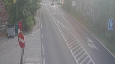

Few settlements in the Federation of Bosnia and Herzegovina have a history as closely tied to the rural life of the Dinaric interior as Vucinici. Set in wooded uplands near Kladanj, it belongs to the Konjuh mountain area, where narrow valleys and forest roads connect scattered hamlets. The Drinjača River rises in this part of northeastern Bosnia and runs through nearby Kladanj, a town known for the Ottoman-era Kuršumlija Mosque. Vucinici is best understood as part of this quiet highland setting rather than as an urban destination. Find related webcams around Kladanj and the Konjuh area to build a fuller picture of northeastern Bosnia.
1 webcam
The Federation of Bosnia and Herzegovina combines rugged highlands with milder Herzegovinian river valleys in a way that reflects its position within the Dinaric Alps of the western Balkans. One of the two entities of Bosnia and Herzegovina, it extends from the Una basin near the Croatian border to the Neretva valley and the Adriatic-facing south. Sarajevo is its capital, while Mostar’s Old Bridge, rebuilt after the 1990s war and inscribed on UNESCO’s World Heritage List, remains a powerful symbol of the country’s urban heritage. Ottoman-era bazaars, mosques and bridges stand alongside Austro-Hungarian streetscapes, particularly in Sarajevo. Browse additional webcams from the surrounding area to extend your view of the Federation of Bosnia and Herzegovina.
77 webcams
Bosnia and Herzegovina is best known internationally for Mostar’s Old Bridge, the stone arch over the Neretva River rebuilt after the 1990s war. The country lies in the Dinaric Alps, where karst plateaus, steep valleys and fast rivers shape much of the terrain. Sarajevo combines Ottoman-era lanes in Baščaršija with Austro-Hungarian architecture, reflecting its role as a meeting point of cultural traditions. In the south, the Neretva valley leads towards a short Adriatic coastline near Neum, while the Una River is known for its waterfalls. Browse additional webcams from the surrounding area to extend your view of Bosnia and Herzegovina.
98 webcams