 Wesley Vale: Temora - YTEM -> NW
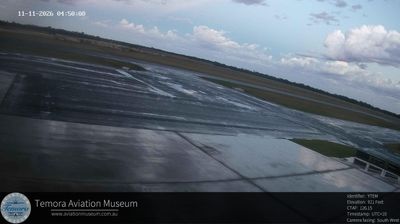
The landscape around Temora is broad, gently undulating Riverina farmland, which has shaped both the built environment and local life. Set in New South Wales’ inland wheat-growing country, the town developed beside Bland Creek, within the Murrumbidgee River catchment. Temora Airport lies on its outskirts and is home to the Temora Aviation Museum, known for preserving and operating historic military aircraft, including former Royal Australian Air Force types. The museum’s aviation displays give the small regional centre an identity far beyond its size. In town, the railway station and commercial streets recall Temora’s growth alongside the settlement of the agricultural district. Grain production remains central to the surrounding plain, where open paddocks, roads and airfield infrastructure share a spacious setting.
Generated by AI


Wesley Vale occupies a low coastal plain in northern Tasmania, just inland from Bass Strait. This small rural locality sits between Devonport and Port Sorell, in an area shaped by productive farmland and the temperate maritime conditions of Tasmania’s north coast. The nearby Rubicon River estuary and Port Sorell’s long sandy shoreline bring a distinctly coastal dimension to the district, while Devonport provides the region’s principal urban and ferry link to mainland Australia. Wesley Vale’s character is quiet and agricultural rather than urban. Explore additional webcams nearby to see how Wesley Vale’s coastal plain relates to Bass Strait and northern Tasmania.
3 webcams
Among Australia’s regions, Tasmania stands out for its island setting south of Bass Strait and its large tracts of protected wilderness. Rugged mountain country, temperate rainforest and a deeply indented coastline give the state a character distinct from mainland Australia. Cradle Mountain–Lake St Clair National Park forms part of the Tasmanian Wilderness World Heritage Area, while Lake St Clair lies among the Central Highlands. On the Tasman Peninsula, Port Arthur preserves one of Australia’s best-known former convict settlements and is included in the UNESCO-listed Australian Convict Sites. Trace Tasmania’s place between Bass Strait and the Southern Ocean by browsing webcams nearby.
57 webcams
Australia’s terrain extends from tropical rainforests in the northeast to arid plains in the interior, producing dramatic climatic contrasts. The Great Dividing Range follows much of the eastern coast, while the Great Barrier Reef lies off Queensland in the Coral Sea and Uluru rises from the central desert. Aboriginal and Torres Strait Islander peoples maintain living cultures whose connections to Country long predate European settlement. In Sydney, the sail-like Opera House, completed in 1973, stands beside one of the world’s best-known harbours. Discover further points of interest through webcams located across Australia.
1.5K webcams