 Northern Community: Griffith - YGTH -> NE
Griffith is best known within the Riverina for its central role in the Murrumbidgee Irrigation Area. Established as an irrigation settlement in 1916, this New South Wales city grew from a planned inland community into a service centre for farms, vineyards and food producers. The Murrumbidgee River, north of the city, supplies the irrigation system that shaped local orchards, rice fields and wine production. Italian migration, particularly after the Second World War, left a lasting mark on Griffith’s food culture and family-run wineries. Northern Community forms part of the city’s residential fabric amid the broad agricultural plains of inland south-western New South Wales.
Generated by AI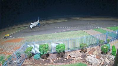


Northern Community has served as a pastoral farming district in northern Southland since European settlement in the nineteenth century. Set within the Oreti River basin, this sparsely populated interior is defined by working farmland and long rural roads rather than an urban centre. The Takitimu and Eyre Mountains shape the wider horizon, while nearby Mossburn is closely associated with New Zealand’s deer-farming industry. State Highway 94 links the area with Te Anau and Fiordland to the west, as well as settlements across Southland. Discover other points of interest through webcams located across Northern Community and Southland.
6 webcams
Southland occupies New Zealand’s southern mainland, between Fiordland’s mountains and the waters of Foveaux Strait. Its western reaches are shaped by Fiordland National Park, where deep fiords, rainforest and lakes such as Te Anau define a far more rugged character than the region’s eastern plains. The Waiau River links the inland lakes with the coast, while Rakiura/Stewart Island lies beyond the strait. Farming remains central to Southland’s identity, alongside the celebrated Bluff oyster fishery. Continue through nearby webcams to explore different parts of Southland.
28 webcams
New Zealand combines Pacific isolation with strong ties to the wider South Pacific in a way that reflects its position between the Tasman Sea and the open Pacific Ocean. The country’s two main islands are divided by Cook Strait, while the Southern Alps run along much of the South Island and include Aoraki / Mount Cook, its highest mountain. On the North Island, volcanic terrain shapes Tongariro National Park and the central plateau; long coastlines frame cities such as Auckland and Wellington. Māori culture is central to national life, and the Treaty of Waitangi, first signed in 1840, remains a foundational document in relations between Māori and the Crown. See how New Zealand fits within the wider South Pacific by browsing webcams nearby.
448 webcams