 District of Ružomberok: Ruzomberok
The landscape around Ružomberok is a broad valley floor edged by wooded foothills, which has shaped both the built environment and local life. The town stands where the Váh and Revúca rivers meet, between the Greater Fatra, the Choč Mountains and the Low Tatras. Ružomberok Aerodrome (LZRU) occupies open grassland on this valley floor, with hangars and space for light aircraft and gliders that support sport flying. Beyond the town, Vlkolínec is a UNESCO World Heritage-listed settlement of traditional timber houses, recognized for its exceptionally well-preserved rural architecture. The airfield, river valley and surrounding ranges illustrate how closely transport, settlement and mountain terrain meet in northern Slovakia.
Generated by AI



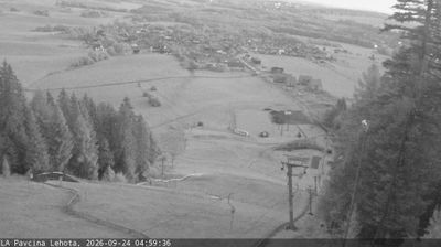


The landscape around the District of Ružomberok is defined by the meeting of the Váh and Revúca valleys below the Greater Fatra mountains, which has shaped both the urban form and local economy. Ružomberok developed as a rail and industrial centre in northern Slovakia, and paper production remains a major local activity through the Mondi Ružomberok mill. The town also provides access to Malinô Brdo, a mountain recreation area on the slopes above the valley. Within its municipal territory, Vlkolínec is a UNESCO World Heritage-listed settlement that preserves log houses and the layout of a traditional mountain community. See how Ružomberok belongs to the wider Liptov area by browsing webcams nearby.
8 webcams
The Region of Žilina is best known in Slovakia for its concentration of Carpathian mountain ranges. In the country’s north, it brings together the valleys of Orava, Kysuce, Liptov and Turiec, with the Váh—Slovakia’s longest river—running through its central corridor. Malá Fatra is a defining presence, while parts of the Western Tatras and the High Tatras lie within the region. Orava Castle, set high above the Orava River, is among Slovakia’s best-known medieval fortresses. Near Ružomberok, Vlkolínec preserves a traditional mountain settlement inscribed on the UNESCO World Heritage List. Discover how the Region of Žilina connects with northern Slovakia by browsing webcams in the surrounding area.
66 webcams
Slovakia is best known internationally for the High Tatras, whose granite summits form the country’s most celebrated mountain landscape. Gerlachovský štít, at 2,655 metres, is the highest peak in Slovakia and in the Carpathians. The Danube runs past Bratislava, where Bratislava Castle stands on a hill above the river, linking the capital to Central Europe’s major waterway. Beyond the cities, forests, karst terrain and small historic towns define much of the country. Slovakia’s long folk tradition is also represented by the fujara, a large shepherd’s flute recognised by UNESCO. Browse additional webcams from the surrounding area to extend your view of the High Tatras and the Danube region.
280 webcams