 Koszalin: Morska
The Dzierżęcinka River defines the setting of Koszalin — its lowland course runs through a regional city between Chełmska Hill and Poland’s Baltic coast. Morska Street belongs to the city’s urban fabric, where broad carriageways, junctions, pavements and service premises give the district a practical, everyday character. Koszalin received town rights in 1266, and its older centre retains the Gothic Cathedral of the Immaculate Conception of the Blessed Virgin Mary. The city is an important administrative, educational and commercial centre for this part of West Pomerania. Morska places historic Koszalin in a contemporary setting of local movement and roadside business.
Generated by AI

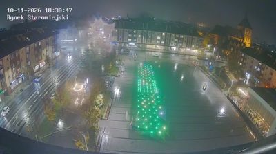


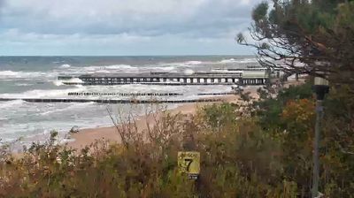
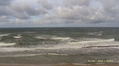


The Dzierżęcinka River defines the setting of Koszalin — its course through the city links the urban centre with the lowland country leading toward Lake Jamno and the Baltic coast. Once a Hanseatic town, Koszalin retains a compact historic core where the Gothic Cathedral of the Immaculate Conception, begun in the 14th century, is its principal monument. The city also sits beneath Chełmska Hill, a wooded rise associated with recreation and a medieval pilgrimage tradition. Streets combine post-war development with older civic fabric, while parks and watercourses soften the centre. Move on to other webcams in the region to compare landscapes and settings around West Pomeranian Voivodeship.
4 webcams
Among Poland’s voivodeships, West Pomeranian Voivodeship stands out for its Baltic coastline and lake-dotted interior. Its northern edge includes broad beaches, dunes and the islands around Świnoujście, while the Oder estuary and Szczecin Lagoon link the coast with inland waterways. Farther east and south, forests and lakes shape areas such as the Drawsko Lake District. Szczecin, the regional capital, retains the Pomeranian Dukes’ Castle, a reminder of the city’s long role as a Baltic port. Move on to other webcams in the region to compare coastal, lake-district and city settings around West Pomeranian Voivodeship.
47 webcams
Poland stretches from the Baltic Sea coast in the north to the Carpathian Mountains along its southern frontier, encompassing broad lowlands, lake districts and upland ranges. The Vistula, the country’s longest river, links Kraków and Warsaw before reaching the Baltic near Gdańsk, while the Masurian Lake District is defined by a dense network of lakes. Kraków’s historic centre, including Wawel Castle, recalls Poland’s former royal capital; Warsaw’s rebuilt Old Town speaks to the city’s recovery after the Second World War. The Białowieża Forest preserves one of Europe’s last primeval lowland forests and is home to European bison. Follow how Poland’s regions relate to one another by browsing webcams across the country.
717 webcams