 Delmenhorst: Rathausplatz
Among the towns of Lower Saxony, Delmenhorst stands out for Rathausplatz, its central civic square. The open, paved space gives the compact centre a clear focus, with municipal buildings, shops and older brick façades around its edges. Delmenhorst lies on the Delme, a small river that continues north toward the Ochtum and the Weser. The city developed strongly through the textile industry; the former Nordwolle wool-mill complex remains a significant part of its industrial heritage. Rathausplatz is used for markets and public gatherings, bringing everyday civic life into the centre of this city west of Bremen.
Generated by AI



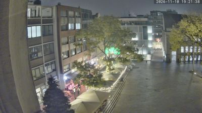



Tucked into the low-lying North German Plain of Lower Saxony, Delmenhorst is a place whose character is shaped by level terrain and the small River Delme. The river gives the city its name and runs through an urban setting just west of Bremen, placing Delmenhorst within the wider metropolitan area while preserving its own industrial identity. That history is especially visible at Nordwolle, the former wool-combing and spinning-mill complex, whose brick factory buildings form a major part of the city’s industrial heritage. Residential districts, green spaces and daily life now stand alongside this legacy. Discover other points of interest through webcams located across Lower Saxony.
1 webcam
Lower Saxony extends from the North Sea coast to the Harz Mountains, encompassing Wadden Sea mudflats, broad lowlands and wooded uplands. At its northern edge, the Lower Saxon Wadden Sea forms part of the UNESCO-listed Wadden Sea, shaped twice daily by the tides. The Weser crosses the state on its way to the North Sea, while the Elbe marks much of its northeastern border. Inland, the Lüneburg Heath is associated with heather moorland and long-standing sheep farming. Hanover, the state capital, is known for the Herrenhausen Gardens, whose Great Garden is a major baroque ensemble. Explore further webcams across Lower Saxony to place the region in its wider geographic context.
198 webcams
Germany stretches from the North Sea and Baltic Sea coasts to the Alps on its southern border, encompassing northern plains, river valleys and forested uplands. The Rhine, Danube and Elbe have long connected its regions, while the Black Forest and Bavarian Alps give the south a more dramatic relief. Berlin’s Brandenburg Gate and Museum Island reflect the capital’s role in German history and culture. Cologne Cathedral, a UNESCO World Heritage Site, rises above the Rhine, and the Bauhaus movement, founded in Weimar in 1919, transformed modern design far beyond Germany. Regional cooking, Christmas markets and brewing traditions bring further character to daily life. Browse additional webcams from the surrounding area to extend your view of Germany.
2.8K webcams