 Freire: › North
Maquehue Airfield has served as an aviation centre in Chile’s Araucanía Region since 1940. On the broad Central Valley west of the Andes, it stands amid a working landscape of fields, pasture, drainage channels and tree lines. It was Temuco’s main airport until commercial operations transferred to La Araucanía Airport in 2014. The surrounding region forms part of the historic homeland of the Mapuche people, whose language, traditions and communities remain central to Araucanía’s identity. Its open setting near Temuco and Freire places aviation infrastructure within one of southern Chile’s important farming areas, where grain cultivation and livestock are long-established activities.
Generated by AI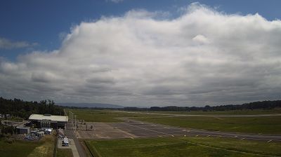

Freire lies beside the Quepe River in Chile’s Araucanía Region, where the agricultural Central Valley is crossed by waterways descending from the Andes. Set south of Temuco on Route 5, the town is a local centre for a commune of fields, small settlements and Mapuche communities. Its name commemorates Ramón Freire, an early Chilean republican military leader who served as president in the 1820s. Freire stands within the traditional territory of the Mapuche people, whose language and cultural presence remain integral to Araucanía. Continue with other webcams from the Araucanía Region to see how this part of southern Chile connects regionally.
2 webcams
Shaped around the basins of the Cautín and Toltén rivers, Araucanía Region has developed into a southern Chilean centre of Mapuche culture, farming, forestry and travel. The Andes form its eastern edge, where Villarrica—one of Chile’s most active volcanoes—rises above Lake Villarrica. Conguillío National Park is known for its ancient araucaria forests and volcanic terrain, while Temuco serves as the regional capital and main urban hub. Mapuche traditions remain central to local identity, expressed through communities, crafts and the Mapudungun language. Discover other points of interest through webcams located across Araucanía Region.
5 webcams
Among the countries of South America, Chile stands out for its exceptional north-to-south extent between the Andes and the Pacific Ocean. The Atacama Desert in the north is one of the driest places on Earth, while the south reaches into Patagonia, where Torres del Paine National Park is known for its jagged granite peaks, glaciers and lakes. Chile also includes Rapa Nui, the Pacific island famed for its monumental moai statues. In Valparaíso, steep hills, funicular railways and colourful historic neighbourhoods reflect the country’s maritime past; its historic quarter is a UNESCO World Heritage Site. Find related webcams in the surrounding area to build a fuller picture of Chile’s Pacific coast and Andean regions.
104 webcams