 Bila Tremesna
Built around a historic rural settlement in the foothills of the Krkonoše, Bílá Třemešná grew into a municipality beside the upper Elbe. Its best-known landmark is the Les Království Dam, completed in 1919 to control flooding on the Elbe downstream. Rather than the plain concrete profile of many reservoirs, the dam was conceived in a monumental stone style: turreted gatehouses stand at the crest, while a long masonry wall spans the wooded valley. The reservoir lies just upstream of Dvůr Králové nad Labem, where the Elbe continues through the Podkrkonoší landscape. Les Království is valued not only as water-management infrastructure but also as an unusually theatrical work of early-20th-century Czech engineering.
Generated by AI



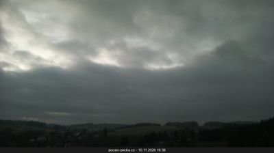



The landscape around Bílá Třemešná is rolling, partly wooded foothill country below the Krkonoše Mountains, which has shaped both the village’s scattered settlement pattern and its farming tradition. In the Trutnov District of northeastern Czechia, fields and small woods lead towards the higher mountain range. Its best-known landmark is the Les Království Dam on the Elbe, built between 1910 and 1920; the stone-faced dam and reservoir are notable examples of early-20th-century water engineering. Bílá Třemešná provides a quieter perspective on the transition between the Elbe valley and the Krkonoše foothills. Find related webcams in the surrounding Krkonoše foothills and Elbe valley to build a fuller picture of northeastern Bohemia.
1 webcam
The Krkonoše Mountains and the upper Elbe define much of Královéhradecký kraj - mountain resorts and winter sports have long supported its tourism economy. On the Polish border, Sněžka reaches 1,603 metres, making it Czechia’s highest mountain, and stands within Krkonoše National Park. The Elbe rises in these mountains before flowing through the region’s lower country. Hradec Králové, the regional capital, combines a historic core with notable early-20th-century architecture linked to Josef Gočár and Jan Kotěra. Farther east, the sandstone formations of the Adršpach–Teplice Rocks introduce a sharply different terrain. View additional webcams nearby to better understand how Královéhradecký kraj connects its mountain borderlands with the Elbe lowlands.
136 webcams
The terrain of Czechia ranges from fertile lowlands in southern Moravia to mountain ridges along the northern frontier, giving this Central European country a distinctly varied geography. The Vltava runs through Prague before joining the Elbe, while the Krkonoše form part of the border with Poland and include Sněžka, Czechia’s highest mountain. Prague’s historic centre, with Prague Castle and Charles Bridge, reflects the city’s long role as a political and cultural centre. Beyond the capital, Bohemia is known for spa towns and brewing, and Moravia for wine-growing traditions. View additional webcams nearby to better understand how Czechia relates to its Central European surroundings.
1.4K webcams