 Sawara Ward
Built around the lower Muromi River and its long-settled farming communities, Sawara Ward grew into Fukuoka City’s expansive western ward, extending from the Momochi waterfront to the wooded Sefuri Mountains. Its northern coast is part of the modern Seaside Momochi district, where Fukuoka Tower rises 234 metres; farther inland, roads cross steep, densely forested valleys toward the prefectural border. The Muromi flows north through the ward to Hakata Bay, linking these uplands with the city. Sawara also contains Fukuoka City Museum, home to the National Treasure gold seal associated with the ancient state of Na. This mix of coast, urban development and mountain infrastructure gives the ward an unusually broad range within Fukuoka.
Generated by AI


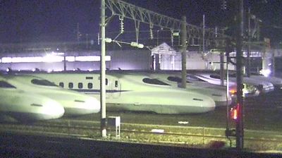

Tucked between Fukuoka City’s built-up districts and the wooded slopes of the Sefuri Mountains, Sawara Ward is a place whose character is shaped by its long reach from Hakata Bay to the inland highlands. The ward belongs to Fukuoka’s western side: coastal Momochihama is part of its territory, while the south becomes markedly more rural and mountainous. Fukuoka Tower, a 234-metre landmark beside the bay, stands in Sawara’s Momochihama area; nearby, the Fukuoka City Museum holds the gold seal discovered on Shikanoshima, an artefact designated a National Treasure. This contrast between contemporary waterfront development, residential neighbourhoods and forested uplands reveals Fukuoka beyond its central commercial districts. Browse additional webcams from the surrounding area to extend your view of Fukuoka and the Sefuri Mountains.
1 webcam
Fukuoka Prefecture runs from the Genkai Sea on Kyushu’s north coast to the Ariake Sea in the south, encompassing dense urban plains, island-dotted shores and wooded interior hills. It is a major centre of northern Kyushu: Fukuoka City developed around the old merchant port of Hakata, while Kitakyushu stands by the Kanmon Strait between Kyushu and Honshu. The Chikugo River reaches the Ariake Sea through the prefecture’s south, and the Itoshima coast opens west of the city. Dazaifu Tenmangu, dedicated to the scholar and statesman Sugawara no Michizane, reflects the area’s long political and religious importance. Move on to other webcams in the region to compare landscapes and settings around Fukuoka Prefecture.
21 webcams
Among the countries of East Asia, Japan stands out for its volcanic archipelago, stretching from the cool north of Hokkaido to subtropical Okinawa. Mount Fuji, the nation’s highest mountain, rises above central Honshu, while the Pacific Ocean and the Seto Inland Sea have long shaped settlement, fishing and travel. Tokyo pairs dense urban life with major museums and neighbourhood traditions; Kyoto preserves temples, gardens and the legacy of Japan’s imperial court. Seasonal customs give journeys a changing rhythm, from spring cherry blossom viewing to autumn leaves. Regional cooking is equally varied, with sushi, ramen and local specialties reflecting coastlines, climate and agriculture. Explore nearby webcam locations that provide complementary perspectives on Japan’s islands, cities and mountain regions.
1.3K webcams