 Osnaburg: Osnabrück-Atterheide Airport
The North German Plain defines the setting of Osnabrück-Atterheide Airport — open agricultural land and belts of woodland give this northern edge of Osnabrück a spacious, low-lying character. The airfield lies in Lower Saxony, northwest of the city centre, where the plain approaches the Wiehen Hills and the Teutoburg Forest. It is a civil aviation site with a paved runway, taxiways and an apron, serving the smaller-scale side of regional flying. Osnabrück is internationally associated with the Peace of Westphalia: treaties ending the Thirty Years’ War were negotiated here and in Münster in 1648. The city’s historic Town Hall of Peace remains a reminder of that diplomatic role.
Generated by AI


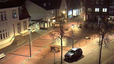





Few cities in Lower Saxony have a history as closely tied to the Peace of Westphalia as Osnabrück. The Hase runs through this northwest German city, set between the Teutoburg Forest and the Wiehen Hills. From 1643 to 1648, Osnabrück and Münster hosted negotiations that ended the Thirty Years’ War; the treaties signed in the two cities form the Peace of Westphalia. The late-Gothic Town Hall, where the Osnabrück treaty was concluded, remains the centrepiece of the market square. Osnabrück also has a contemporary cultural landmark in the Felix Nussbaum Haus, designed by Daniel Libeskind and devoted to the Jewish artist born here. Discover other points of interest through webcams located across Osnabrück and Lower Saxony.
3 webcams
Lower Saxony extends from the North Sea coast to the Harz Mountains, encompassing Wadden Sea mudflats, broad lowlands and wooded uplands. At its northern edge, the Lower Saxon Wadden Sea forms part of the UNESCO-listed Wadden Sea, shaped twice daily by the tides. The Weser crosses the state on its way to the North Sea, while the Elbe marks much of its northeastern border. Inland, the Lüneburg Heath is associated with heather moorland and long-standing sheep farming. Hanover, the state capital, is known for the Herrenhausen Gardens, whose Great Garden is a major baroque ensemble. Explore further webcams across Lower Saxony to place the region in its wider geographic context.
163 webcams
Germany stretches from the North Sea and Baltic Sea coasts to the Alps on its southern border, encompassing northern plains, river valleys and forested uplands. The Rhine, Danube and Elbe have long connected its regions, while the Black Forest and Bavarian Alps give the south a more dramatic relief. Berlin’s Brandenburg Gate and Museum Island reflect the capital’s role in German history and culture. Cologne Cathedral, a UNESCO World Heritage Site, rises above the Rhine, and the Bauhaus movement, founded in Weimar in 1919, transformed modern design far beyond Germany. Regional cooking, Christmas markets and brewing traditions bring further character to daily life. Browse additional webcams from the surrounding area to extend your view of Germany.
2.1K webcams