 District of Banská Bystrica: Králiky
The Kremnické vrchy define the setting of Králiky — this small settlement above Banská Bystrica follows a mountain-side corridor of homes, local roads and forested ground. It belongs to central Slovakia’s former mining country, where Banská Bystrica developed as an important medieval mining town. Králiky is part of the recreation belt west of the city, with woodland terrain used for walking and cycling. Its built form remains distinctly residential: detached houses line the rising road rather than gathering around an urban centre. The nearby regional city provides practical connections, while the surrounding uplands preserve the locality’s small scale.
Generated by AI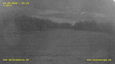





District of Banská Bystrica combines the activity of a regional centre with a mountainous setting in a way that reflects its position in central Slovakia. The Hron River runs through Banská Bystrica, while the Low Tatras and the Kremnica Mountains shape the wider district. In the city’s historic core, SNP Square is lined with substantial burgher houses and overlooked by the Clock Tower. Banská Bystrica played a major role in the Slovak National Uprising of 1944, commemorated at the Museum of the Slovak National Uprising. Explore additional webcams nearby to better understand how the Banská Bystrica region relates to its surrounding mountains and valleys.
13 webcams
Mountain ranges and river valleys define much of the Region of Banská Bystrica - forestry, farming and former mining settlements have long developed around this rugged central Slovak terrain. The Hron, one of Slovakia’s principal rivers, runs through Banská Bystrica, the regional capital, before continuing south toward the Danube. North of the city, the Low Tatras form a major part of the region, while the Slovak Ore Mountains extend across its central and eastern areas. Banská Bystrica grew as a medieval mining town and is home to the Museum of the Slovak National Uprising, documenting the resistance movement of 1944. See how the Region of Banská Bystrica connects with central Slovakia by browsing webcams nearby.
43 webcams
Slovakia is best known internationally for the High Tatras, whose granite summits form the country’s most celebrated mountain landscape. Gerlachovský štít, at 2,655 metres, is the highest peak in Slovakia and in the Carpathians. The Danube runs past Bratislava, where Bratislava Castle stands on a hill above the river, linking the capital to Central Europe’s major waterway. Beyond the cities, forests, karst terrain and small historic towns define much of the country. Slovakia’s long folk tradition is also represented by the fujara, a large shepherd’s flute recognised by UNESCO. Browse additional webcams from the surrounding area to extend your view of the High Tatras and the Danube region.
237 webcams