 Sankt Martin am Tennengebirge: Lammertal - Lungötz - Fritzerkogel - Annaberg-Lungötz - Torstein - Hoher Dachstein - Bischofsmütze

Sankt Martin am Tennengebirge lies in the Lammertal valley, where wooded slopes and working pastureland rise towards the pale limestone mass of the Tennengebirge. This Salzburg settlement occupies a quieter part of a mountain district shaped by farming, forests and routes through the northern Alps. Nearby Annaberg-Lungötz is a separate municipality in the Lammertal, while Lungötz is one of its principal villages. The jagged Bischofsmütze belongs to the Gosaukamm, a limestone range on the northern side of the Dachstein massif. Hoher Dachstein, at 2,995 metres, is the highest mountain in Styria and Upper Austria; Torstein is another major summit of the same massif. Together with Fritzerkogel, these peaks define the valley’s alpine setting. Alpine pasture farming remains an important part of local land use alongside woodland and small settlements.
Generated by AI




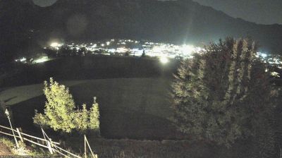

Tucked into the Lammertal beneath the limestone Tennengebirge massif, Sankt Martin am Tennengebirge is a place whose character is shaped by its high-Alpine setting and the course of the Lammer. The municipality lies in Salzburg’s Pongau district, where woodland, pasture and steep rock faces create a distinctly mountain-bound setting. Tennengebirge is a major karst range, with caves and high plateaus forming part of the terrain around the settlement. The parish church dedicated to St Martin provides a local cultural focal point. Summer brings walking and mountain excursions, while winter gives the valley a calmer, snow-season rhythm. Continue through nearby webcams to explore different parts of the Lammertal and Salzburg mountains.
2 webcams
Salzburg is renowned in Austria for its UNESCO-listed Baroque capital and the musical legacy of Wolfgang Amadeus Mozart. Beyond the city, the Salzach runs south through broad valleys and market towns before the land rises into the Northern Limestone Alps and the Hohe Tauern. The province includes much of Hohe Tauern National Park, Austria’s largest national park, where high alpine terrain meets traditional pasture farming. Salt shaped Salzburg’s prosperity for centuries, while Hohensalzburg Fortress remains a defining landmark above the historic centre. Winter sports and summer hiking bring out the contrast between river valleys and mountain country. Explore other webcams in the region to compare landscapes and settings around Salzburg.
414 webcams
Austria stretches from the Bohemian Massif along its northern edge to the Carnic Alps on the Italian border, encompassing high Alpine ranges and the Danube lowlands. The Danube links cities including Linz and Vienna, while the Grossglockner, at 3,798 metres, is the country’s highest mountain. Vienna developed for centuries as the seat of the Habsburg court, leaving imperial architecture around the Hofburg and Schönbrunn Palace. Salzburg is closely associated with Wolfgang Amadeus Mozart, who was born there in 1756. Alpine Tyrol, wine-growing areas east of Vienna and the lakes of Salzkammergut add markedly different regional identities. Browse other webcams across Austria to place this setting in a wider geographic context.
3.1K webcams