 Reykjavik: Korngarðar - Harbour
Built around a natural harbour on Faxaflói Bay, Reykjavík grew into Iceland’s capital and largest urban centre. Korngarðar belongs to the city’s working waterfront, a zone of quays, cargo facilities and marine industry rather than the restaurant-lined Old Harbour. This side of the port reflects the practical role that sea transport continues to play for an island nation. Reykjavík began as a farmstead traditionally associated with the settler Ingólfur Arnarson, and its harbour later helped turn a small settlement into the country’s political and commercial focus. Across the bay, the low, open shoreline places the port within the broad coastal setting of southwest Iceland. The contrast between utility infrastructure and the compact capital gives Korngarðar a distinctly functional urban character.
Generated by AI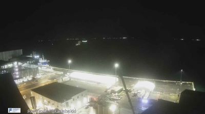




Few cities in Iceland have a history as closely tied to the country’s settlement and nation-building as Reykjavík. On Faxa Bay, with Mount Esja rising across the water, the capital is Iceland’s political and cultural centre. Reykjavík is traditionally associated with Ingólfur Arnarson, regarded in Icelandic tradition as the first permanent Norse settler, who settled here in the late ninth century. Alþingi, Iceland’s parliament, has met in the city since 1845, while Hallgrímskirkja and Harpa concert hall define distinct parts of its modern skyline. Discover further points of interest through webcams situated across Reykjavík and Iceland’s Capital Region.
8 webcams
Capital Region has served as Iceland’s administrative and cultural heartland within the country since the mid-19th century. Centered on Reykjavík and its neighbouring municipalities, it occupies the shore of Faxaflói Bay, where low lava-built ground meets the North Atlantic. Reykjavík is Iceland’s largest urban area and the home of Alþingi, the national parliament, which has met in the city since 1845. Hallgrímskirkja and Harpa concert hall define a compact capital whose museums, geothermal pools and harbour life connect contemporary Iceland with maritime traditions. Beyond the urban coast, the wider area reaches toward the volcanic terrain of the Reykjanes Peninsula. Find related webcams in the surrounding area to build a fuller picture of Iceland’s Capital Region.
56 webcams
Iceland occupies a volcanic North Atlantic island on the Mid-Atlantic Ridge, between Europe and North America. Glaciers, black-sand shores and active geothermal areas form a terrain in constant dialogue with the weather; Vatnajökull is Europe’s largest glacier by volume. The Golden Circle links Þingvellir National Park, the Geysir geothermal area and Gullfoss waterfall, while Reykjavík concentrates much of the country’s contemporary culture and design. At Þingvellir, the Alþingi first assembled in 930. Fishing, wool knitwear and geothermal energy remain central to Icelandic life. Find related webcams in the surrounding area to build a fuller picture of Iceland.
628 webcams