 Nowy Sacz
Nowy Sącz combines the civic grandeur of its Market Square with the low, wooded hills around it in a way that reflects its position in the Dunajec valley of Lesser Poland. The square is anchored by the neo-Renaissance Town Hall, built at the end of the 19th century after an earlier building was destroyed by fire. Streets around it retain a compact historic core, while the city spreads across the confluence area of the Dunajec and Kamienica rivers. Founded in the 13th century, Nowy Sącz developed as an important trading town on routes between Kraków and Hungary. Its urban centre and surrounding foothills give the city a distinctive southern Polish character.
Generated by AI

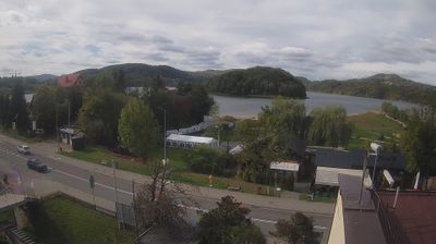




Founded where the Dunajec meets the Kamienica Nawojowska, Nowy Sącz developed into a regional centre of southern Poland. The city occupies the Sącz Basin, with the Beskid Sądecki rising to the south and the Dunajec valley shaping routes through the area. Granted town rights in 1292, it has long been associated with the historic Sącz region. The Sądecki Ethnographic Park presents timber buildings relocated from across the area, while the adjacent Galician Town recalls the streetscape of the former Austrian partition. Browse further webcams around Nowy Sącz to see how the Sącz Basin connects with the Beskid foothills.
1 webcam
The Vistula valley and the Carpathian foothills shape much of Lesser Poland Voivodeship, linking Kraków’s metropolitan life with farming districts and mountain tourism along its southern edge. Kraków, Poland’s former royal capital, remains the cultural centre: Wawel Castle and the medieval Old Town stand above the river, within a UNESCO World Heritage-listed historic core. Farther south, the Dunajec cuts through the Pieniny, while the Tatra Mountains form a highland frontier with Slovakia. The Wieliczka Salt Mine, worked from the Middle Ages, recalls the importance of salt to the old Polish state. Move on to other webcams in the region to compare landscapes and settings around Lesser Poland Voivodeship.
82 webcams
Poland stretches from the Baltic Sea coast in the north to the Carpathian Mountains along its southern frontier, encompassing broad lowlands, lake districts and upland ranges. The Vistula, the country’s longest river, links Kraków and Warsaw before reaching the Baltic near Gdańsk, while the Masurian Lake District is defined by a dense network of lakes. Kraków’s historic centre, including Wawel Castle, recalls Poland’s former royal capital; Warsaw’s rebuilt Old Town speaks to the city’s recovery after the Second World War. The Białowieża Forest preserves one of Europe’s last primeval lowland forests and is home to European bison. Follow how Poland’s regions relate to one another by browsing webcams across the country.
711 webcams