 Natales: Teniente Julio Gallardo Airport
Tucked between the Patagonian steppe and the shoreline of Última Esperanza Sound, Teniente Julio Gallardo Airport is a place whose character is shaped by the exposed plains of southern Chile. It serves Puerto Natales, the provincial capital on the sound, and provides an air link for a small city facing one of Patagonia’s defining fjord landscapes. The surrounding country belongs to Magallanes, where long distances, ranch land and broad, treeless ground shape travel across the region. Puerto Natales was founded in 1911 during the expansion of sheep farming and grew into a service centre for journeys toward Torres del Paine National Park. The airport’s restrained setting belongs to a practical Patagonian transport network rather than a large urban hub.
Generated by AI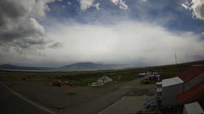

The landscape around Natales is a windswept Patagonian shore along Última Esperanza Sound, which has shaped both the town’s waterfront layout and its economy of sheep ranching, fishing and maritime transport. Officially known as Puerto Natales, it was founded in 1911 and grew as a service port for the large estancias of Chilean Patagonia. Today its streets combine working harbour activity with hotels, cafés and outfitters serving travellers headed into Torres del Paine National Park. The Cueva del Milodón Natural Monument, associated with the discovery of remains of the extinct giant ground sloth, adds an important prehistoric dimension nearby. Discover how Natales connects with Patagonia by browsing webcams across Magallanes.
2 webcams
The terrain of the Region of Magallanes and Chilean Antarctica shifts from Patagonian steppe in the east to the Andes, islands and fjords in the west, creating a far-southern territory exposed to powerful winds. The Strait of Magellan cuts through its mainland and island geography, linking the Atlantic and Pacific oceans. Punta Arenas, on the strait, developed as an important port before the Panama Canal reshaped interoceanic shipping. Farther north, Torres del Paine National Park is known for the granite Paine Massif and glaciers, while the region also extends across Tierra del Fuego and the channels of western Patagonia. Browse additional webcams from the surrounding area to extend your view of Magallanes.
10 webcams
Among the countries of South America, Chile stands out for its exceptional north-to-south extent between the Andes and the Pacific Ocean. The Atacama Desert in the north is one of the driest places on Earth, while the south reaches into Patagonia, where Torres del Paine National Park is known for its jagged granite peaks, glaciers and lakes. Chile also includes Rapa Nui, the Pacific island famed for its monumental moai statues. In Valparaíso, steep hills, funicular railways and colourful historic neighbourhoods reflect the country’s maritime past; its historic quarter is a UNESCO World Heritage Site. Find related webcams in the surrounding area to build a fuller picture of Chile’s Pacific coast and Andean regions.
104 webcams