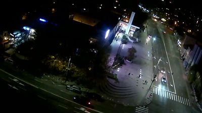
 Brăila: Piața Dorobantilor
Piața Dorobanților combines the order of a planned traffic junction with the everyday bustle of Brăila in a way that reflects its position in a Danube port city. Broad roads converge at a landscaped roundabout, framed by mature trees, apartment blocks and ground-floor businesses; the setting represents the city’s postwar residential fabric. Brăila stands on the left bank of the Danube in eastern Romania, where river trade has long shaped local identity and urban life. The city is also the birthplace of Romanian writer Panait Istrati, whose work drew on the social worlds of the lower Danube. Piața Dorobanților brings Brăila’s practical, lived-in character into focus as a civic crossroads rather than a monumental tourist precinct.
Generated by AI



Brăila sits on the Danube in southeastern Romania, where the Bărăgan Plain meets one of Europe’s great river corridors. Long a strategic port, the city expanded rapidly after 1829, when it returned to Wallachian control and gained importance in the grain trade. Its old centre retains broad, curving streets and commercial buildings from the late 19th and early 20th centuries, recalling an era of Danube and Black Sea trade. The Greek Church of the Annunciation, consecrated in 1872, reflects Brăila’s historic Greek community. The city is also associated with writer Panait Istrati, whose work drew on port life. Continue through nearby webcams to explore different parts of Brăila and the lower Danube.
1 webcam
Brăila stretches from the left bank of the Danube into the Bărăgan Plain, encompassing a historic river port and the flat farmland of southeastern Romania. The Danube remains central to the city’s character: its quays and shipping links long connected Brăila with Black Sea trade and other Danubian ports. In 1836, Brăila was declared a free port, a status that drove major commercial growth during the nineteenth century. Its historic centre still recalls that mercantile era, while the broad river corridor gives the city a distinct Lower Danube setting. Trace Brăila’s place in the wider Lower Danube area by browsing webcams nearby.
2 webcams
The terrain of Romania ranges from the Carpathian Mountains in the centre to the Danube Delta wetlands in the east, creating contrasts between highland forests, fertile plains and reed-filled waterways. The Danube reaches the Black Sea here, and its delta supports abundant bird and aquatic life. Transylvania is marked by medieval towns such as Sibiu and Brașov, while Bucharest is home to the monumental Palace of Parliament, commissioned during the communist era. Orthodox monasteries, folk traditions and regional cuisines add further layers to a country shaped by several historic provinces. Discover other points of interest through webcams located across Romania.
142 webcams