 Zakliczyn: Market square
Zakliczyn is best known within Lesser Poland for its exceptionally large Market Square, the focal point of a compact small-town centre. The town stands near the Dunajec River, among the rolling foothills of southern Małopolska, on the route between Tarnów and Nowy Sącz. Low-rise houses, shops and civic buildings gather around the square, giving the centre an unusually open layout for the region. Zakliczyn is also associated with Piękny Jaś z Doliny Dunajca, a white bean traditionally grown in the Dunajec valley and protected under an EU geographical designation. The annual Bean Festival celebrates this local food tradition. Wooded ridges of the Rożnów Foothills reinforce the rural character of this part of Lesser Poland.
Generated by AI



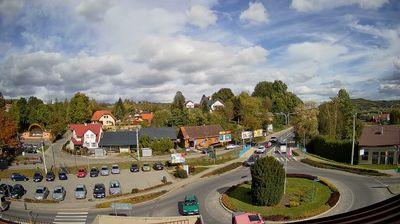
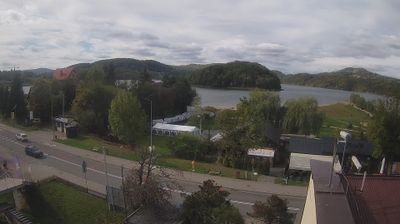
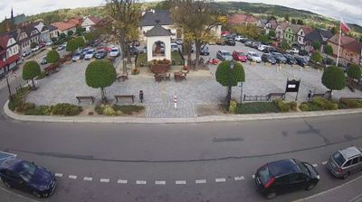

The landscape around Zakliczyn is a rolling Dunajec River valley beneath the outer Carpathian foothills, which has shaped both the town’s layout and its farming traditions. This small Lesser Poland town centres on an unusually broad market square, long a practical meeting point for trade with surrounding villages. Agriculture in the Dunajec valley remains part of local identity: Zakliczyn is associated with the large white Piękny Jaś bean, celebrated during the town’s annual Bean Festival. Its quiet streets and low-rise centre retain the scale of a historic market town, while the wooded hills of the Polish Foothills rise close beyond the river valley. Discover other points of interest through webcams located across Lesser Poland Voivodeship.
4 webcams
The Vistula valley and the Carpathian foothills shape much of Lesser Poland Voivodeship, linking Kraków’s metropolitan life with farming districts and mountain tourism along its southern edge. Kraków, Poland’s former royal capital, remains the cultural centre: Wawel Castle and the medieval Old Town stand above the river, within a UNESCO World Heritage-listed historic core. Farther south, the Dunajec cuts through the Pieniny, while the Tatra Mountains form a highland frontier with Slovakia. The Wieliczka Salt Mine, worked from the Middle Ages, recalls the importance of salt to the old Polish state. Move on to other webcams in the region to compare landscapes and settings around Lesser Poland Voivodeship.
82 webcams
Poland stretches from the Baltic Sea coast in the north to the Carpathian Mountains along its southern frontier, encompassing broad lowlands, lake districts and upland ranges. The Vistula, the country’s longest river, links Kraków and Warsaw before reaching the Baltic near Gdańsk, while the Masurian Lake District is defined by a dense network of lakes. Kraków’s historic centre, including Wawel Castle, recalls Poland’s former royal capital; Warsaw’s rebuilt Old Town speaks to the city’s recovery after the Second World War. The Białowieża Forest preserves one of Europe’s last primeval lowland forests and is home to European bison. Follow how Poland’s regions relate to one another by browsing webcams across the country.
718 webcams