 Karlovac: Jelasi: Karlovac - music pavilion
Jelaši lies along the Kupa in Karlovac, where level riverside ground frames a compact urban quarter beside the historic centre. This setting belongs to a city defined by four rivers—the Kupa, Korana, Mrežnica and Dobra—which have shaped its parks, embankments and routes through central Croatia. Karlovac was established in 1579 as a Renaissance fortress during the Habsburg-Ottoman frontier period; its distinctive six-pointed star plan remains legible in the old town. The nearby Promenade, with its Music Pavilion and mature trees, represents the calmer civic side of a city better known for its fortifications and river confluences. Jelaši connects public green space, everyday neighbourhood life and Karlovac’s historic core.
Generated by AI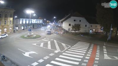








Karlovac’s four rivers—the Kupa, Korana, Mrežnica and Dobra—define the setting of Karlovac, shaping a lowland city where riverbanks are woven into daily life. Founded in 1579 as a Habsburg fortress during the Ottoman wars, the town was laid out on a distinctive six-pointed star plan; parts of its defensive earthworks still encircle the historic centre. The Korana and Kupa bring parks, bathing spots and waterside walks close to the urban core. Karlovac is also closely associated with brewing: Karlovačko beer has been produced here since 1854. See how Karlovac fits within central Croatia by browsing webcams nearby.
2 webcams
Karlovac County combines river-shaped lowlands with rugged karst country in a way that reflects its position between central Croatia and the Dinaric interior. The Kupa, Korana, Mrežnica and Dobra give the area an unusually water-focused identity, running past woodland, fields and settlements before joining larger drainage routes. Karlovac, the county seat, was founded in 1579 as a star-shaped fortress at a strategically important river confluence; its planned historic core still distinguishes it from older Croatian towns. Farther south, the terrain becomes more wooded and limestone-based, with Slunj and the Korana valley marking a transition toward the Plitvice region. Continue with other webcams from the area to see how this part of central Croatia connects regionally.
14 webcams
Croatia occupies a long Adriatic coastline in southeastern Europe. Its shore is broken into islands and sheltered coves, while the Dinaric Alps rise inland and the Danube forms part of its eastern border. Dubrovnik’s fortified old city faces the sea, and Split grew around Diocletian’s Palace, a Roman complex begun in the early fourth century. Inland, Plitvice Lakes National Park is known for terraced lakes linked by waterfalls and has been a UNESCO World Heritage Site since 1979. Istrian olive groves, Zagreb and Slavonia’s vineyards reveal distinct regional identities. Explore nearby webcam locations that provide complementary perspectives on the Adriatic coast and Croatia’s interior.
380 webcams