 Hohentengen: Verkehrslandeplatz Mengen-Hohentengen - Flugplatz
Tucked into the gently rolling farmland of Upper Swabia, Hohentengen is a place whose character is shaped by its open agricultural plain. The community lies near the Danube in Baden-Württemberg, between the regional centres of Sigmaringen and Bad Saulgau. Verkehrslandeplatz Mengen-Hohentengen gives this rural setting a practical aviation role, serving the wider area from an airfield bordered by fields and low wooded rises. Nearby Mengen is an old Danube town whose centre recalls the long settlement history of this part of Swabia. Together, the airfield, cultivated land and modest hills convey a quieter side of southern Germany, away from larger urban corridors.
Generated by AI

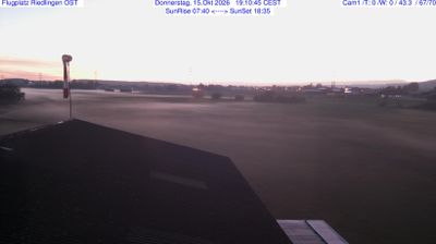
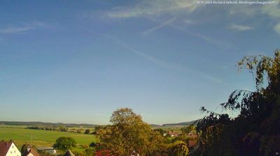


Hohentengen combines a quiet Upper Swabian rural character with a location close to the Danube valley, reflecting its position in southern Baden-Württemberg. The municipality lies in the landscape shaped by the Ostrach, a tributary of the Danube, amid fields and small settlements between Mengen and Bad Saulgau. St. Michael’s parish church is a focal point of the main village, while the wider area retains the dispersed settlement pattern typical of Upper Swabia. Continue with other webcams from Upper Swabia to see how this part of Baden-Württemberg connects regionally.
1 webcam
Baden-Württemberg is best known within Germany for the Black Forest, the wooded upland region that shapes much of the state’s southwest. Its terrain also reaches from the Upper Rhine plain and its wine-growing areas to the limestone ridges of the Swabian Jura, while Lake Constance marks part of the southern frontier. Stuttgart, the state capital, is closely tied to the automobile industry and hosts the Mercedes-Benz Museum and Porsche Museum. Heidelberg’s old town and castle add another important strand to the region’s identity, alongside renowned universities, spas and regional cooking. Find related webcams in the surrounding area to build a fuller picture of Baden-Württemberg.
452 webcams
Germany stretches from the North Sea and Baltic Sea coasts to the Alps on its southern border, encompassing northern plains, river valleys and forested uplands. The Rhine, Danube and Elbe have long connected its regions, while the Black Forest and Bavarian Alps give the south a more dramatic relief. Berlin’s Brandenburg Gate and Museum Island reflect the capital’s role in German history and culture. Cologne Cathedral, a UNESCO World Heritage Site, rises above the Rhine, and the Bauhaus movement, founded in Weimar in 1919, transformed modern design far beyond Germany. Regional cooking, Christmas markets and brewing traditions bring further character to daily life. Browse additional webcams from the surrounding area to extend your view of Germany.
2.1K webcams