 Waidhofen an der Thaya: Lower Austria, Austria
Waidhofen an der Thaya occupies a gently rolling stretch of the Waldviertel on the Thaya River in Lower Austria. As the seat of the Waidhofen an der Thaya district, it brings together administration, shops and services for a largely rural surrounding area. Its historic core is formed by a compact network of streets lined with substantial civic and commercial buildings, giving the town a more urban character than many nearby settlements. The Thaya connects Waidhofen with a river landscape extending toward the Czech border, while the wider Waldviertel is marked by granite ground, woodland and ponds. It is an everyday working town with a clear regional role in northern Lower Austria.
Generated by AI


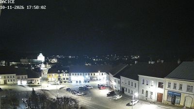


Waidhofen an der Thaya lies along the Thaya River, amid the gently rolling forests, fields and pond country of the Waldviertel in northern Lower Austria. The district town stands near the Czech border, in a region whose granite bedrock has shaped both its soils and building traditions. Its compact historic centre retains sections of the medieval town wall, and the parish church of St Margaret remains a defining landmark. Around the town, small farms and managed woodlands give the landscape a distinctly inland character, far from Austria’s Alpine routes. Continue with other webcams from the Waldviertel to see how this part of Lower Austria connects regionally.
1 webcam
Lower Austria is best known within Austria for the Wachau, the UNESCO World Heritage cultural landscape along the Danube. Austria’s largest federal state extends from the Bohemian Massif in the north to the limestone Alps around Rax and Schneeberg in the south, with vineyards, forests and agricultural districts between them. St. Pölten is the provincial capital, while Melk Abbey rises above the Danube as one of the country’s foremost Baroque monuments. Vienna is a separate federal state, though it is enclosed by Lower Austria. Explore nearby webcam locations that provide complementary perspectives on the Wachau and Lower Austria.
408 webcams
Austria stretches from the Bohemian Massif along its northern edge to the Carnic Alps on the Italian border, encompassing high Alpine ranges and the Danube lowlands. The Danube links cities including Linz and Vienna, while the Grossglockner, at 3,798 metres, is the country’s highest mountain. Vienna developed for centuries as the seat of the Habsburg court, leaving imperial architecture around the Hofburg and Schönbrunn Palace. Salzburg is closely associated with Wolfgang Amadeus Mozart, who was born there in 1756. Alpine Tyrol, wine-growing areas east of Vienna and the lakes of Salzkammergut add markedly different regional identities. Browse other webcams across Austria to place this setting in a wider geographic context.
2.6K webcams