 Barneville-Carteret: Grande Plage de Barneville
Grande Plage de Barneville combines an expansive tidal shore with the built-up rhythm of a Normandy seaside town in a way that reflects its position on the Cotentin coast of the English Channel. The beach is part of Barneville-Carteret, a commune on the Côte des Isles, the western shore of the Cotentin Peninsula. Its sands extend across a broad intertidal zone, where the changing level of the Channel leaves a large foreshore; rock defences mark parts of the boundary between sea and settlement. At the northern end of the commune, Carteret is a harbour with passenger links to the Channel Islands, including Jersey. That maritime connection gives the resort a practical role beyond its beach, while Cap de Carteret creates a headland landmark on this stretch of Normandy coast.
Generated by AI


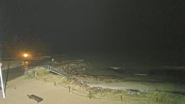


Barneville-Carteret stretches between the English Channel and the Cotentin Peninsula in Normandy, and that exposed coastal position has shaped it as a commune of beaches, harbour life and maritime links. It brings together the historic settlements of Barneville and Carteret, the latter centred on a harbour with seasonal passenger services to the Channel Islands. Cap de Carteret rises above the port, while Barneville-sur-Mer follows a broad sandy shore. The Church of Saint-Germain in Barneville reflects the area’s older architectural heritage. Explore nearby webcam locations that provide complementary perspectives on the Cotentin Peninsula and Normandy coast.
4 webcams
Among France’s regions, Normandy stands out for its Channel coast, fertile farmland and enduring links to medieval and modern European history. The English Channel frames a shoreline of broad beaches, cliffs and working ports, while the Seine crosses the eastern part of the region before reaching the sea near Le Havre. Rouen’s Gothic cathedral and the Bayeux Tapestry are major cultural reference points. Along the Calvados coast, the D-Day landing beaches recall the Allied landings of 1944. Normandy is also closely associated with cider, Camembert and dairy farming, traditions rooted in its green pastures. Move on to other webcams in the region to compare landscapes and settings around Normandy.
103 webcams
The Atlantic and Mediterranean coastlines, together with the Alps, Pyrenees and broad river basins, define much of France — they support maritime trade, farming, wine regions and travel throughout the year. The Seine runs through Paris, where the Eiffel Tower and the Louvre are among Europe’s most recognised landmarks. The Loire Valley is known for Renaissance châteaux, while Mont-Saint-Michel rises from a tidal bay in Normandy. Regional food traditions are equally distinctive, from Breton seafood to Provençal cooking, with bread, cheese and wine central to everyday life. France’s global cultural influence is evident in its language, literature, fashion and cinema. View additional webcams nearby to better understand how France’s coasts, plains and mountain borders relate to their surroundings.
2.2K webcams