 Cervena Voda: Červená Voda - Čenkovice

Among the mountain settlements of the Pardubice Region, Čenkovice stands out for its setting on the slopes of Buková hora. The village belongs to the municipality of Červená Voda and lies in the upland landscape of the Orlické Mountains, close to the historic Bohemia–Moravia boundary. SkiResort Buková hora links Čenkovice with the slopes above Červená Voda, creating one connected area of chairlifts, pistes and forest tracks. The resort took its present form in 2010, when a chairlift joined two formerly separate ski areas. Beyond the developed runs, dense woodland and scattered buildings give the settlement a distinctly enclosed mountain character.
Generated by AI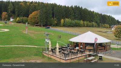



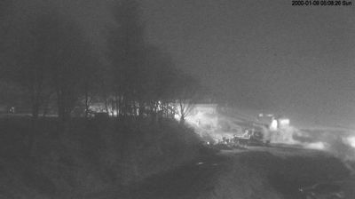



The landscape around Červená Voda is a mix of forested foothills on the edge of the Orlické Mountains, which has shaped both the settlement pattern and local economy. Buková hora, rising above the area, is associated with the Červená Voda mountain resort and gives the municipality a strong winter-sports identity. The local countryside also includes Křížová hora, a pilgrimage site crowned by the Church of the Exaltation of the Holy Cross. Červená Voda lies in eastern Bohemia, close to the historic borderlands between Bohemia and Moravia. Move on to other webcams in the Pardubice Region to compare foothill and upland settings around Červená Voda.
3 webcams
Pardubický kraj has been an eastern Bohemian heartland of the Czech lands since the Middle Ages. The Labe crosses its western lowlands around Pardubice before the terrain rises toward the Orlické Mountains and the Žďárské vrchy. Pardubice developed around its Renaissance castle and is associated with the Pardubice Steeplechase, a race first held in 1874. To the south-east, Litomyšl is known for its Renaissance château, inscribed on UNESCO’s World Heritage List, while Kladruby nad Labem preserves the stud landscape linked to the Kladruber horse. Browse additional webcams nearby to understand how Pardubický kraj meets the lowlands and uplands around it.
100 webcams
The terrain of Czechia ranges from fertile lowlands in southern Moravia to mountain ridges along the northern frontier, giving this Central European country a distinctly varied geography. The Vltava runs through Prague before joining the Elbe, while the Krkonoše form part of the border with Poland and include Sněžka, Czechia’s highest mountain. Prague’s historic centre, with Prague Castle and Charles Bridge, reflects the city’s long role as a political and cultural centre. Beyond the capital, Bohemia is known for spa towns and brewing, and Moravia for wine-growing traditions. View additional webcams nearby to better understand how Czechia relates to its Central European surroundings.
1.4K webcams