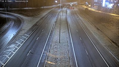
 Keminmaa: Tie4 Kemi, Hepola - Tienpinta
Keminmaa lies along the lower Kemijoki River near the northern end of the Gulf of Bothnia, where low, wooded terrain and settled riverbanks meet the coastal plain. The municipality stands beside Finland’s main north–south road corridor, National Road 4, between Kemi and Tornio, making it a practical stop on journeys through northern Finland. Its most distinctive historic site is the Keminmaa Old Church, an early-16th-century stone church that preserves a rare collection of naturally mummified remains. Agriculture, forestry and local services shape the wider area, while the river’s route towards the Bothnian coast has long connected inland communities with the sea. Keminmaa has the quiet, spacious character of a northern Finnish municipality rather than the denser urban fabric of nearby Kemi.
Generated by AI



Keminmaa has served as a parish centre in the lower Kemijoki valley of northern Finland since the 19th century. The municipality stands near the point where the Kemijoki, Finland’s longest river, approaches the Gulf of Bothnia; its low coastal surroundings combine river channels, cultivated land and forest. Its principal historic monument is St Michael’s Church, a late-medieval stone church generally dated to around 1519 and among Finland’s northernmost medieval stone churches. Browse webcams across the lower Kemijoki valley and Bothnian coast to see how Keminmaa belongs to the wider area.
20 webcams
Built around river valleys, reindeer husbandry and forestry, Lapland developed into Finland’s northernmost and largest region. Long winters, forests and rounded fells define its inland character, while the Kemijoki, Finland’s longest river, drains a large part of the area. Sámi culture is central to the north of the region; Finnish settlements have also long depended on woodland work and river routes. Rovaniemi, Lapland’s administrative centre, stands at the meeting of the Kemijoki and Ounasjoki and is home to the Arktikum science centre and museum. Explore nearby webcam locations that provide complementary perspectives on Finnish Lapland.
202 webcams
The terrain of Finland ranges from low coastal plains along the Gulf of Bothnia to fells in Lapland, creating a country of forests, lakes and long northern distances. More than 180,000 lakes shape everyday life, while the Lakeland region is threaded with waterways and islands. Helsinki, on the Gulf of Finland, combines neoclassical landmarks around Senate Square with contemporary Finnish design. Farther north, the Sámi are Finland’s only recognised Indigenous people, and their culture remains closely connected to the Arctic region. In winter, snow and ice transform the north; in summer, long daylight extends outdoor life well into the evening. Continue through nearby webcams to explore different parts of Finland.
1.7K webcams