 Stribro: Masarykovo náměstí
Stříbro lies in the valley of the Mže River, where the wooded uplands of western Bohemia surround its compact historic centre. Masarykovo náměstí forms the town’s civic heart, an expansive rectangular square lined with burgher houses and marked by the town hall and a Marian column. Stříbro developed as an important medieval centre of silver mining; its name means “silver” in Czech, a direct reminder of that past. Streets lead from the square towards the Mže, while the Church of All Saints and the preserved historic fabric give the centre its distinctive silhouette. About 30 kilometres west of Plzeň, Stříbro is a rewarding stop for exploring the Mže valley and the Plzeň Region.
Generated by AI



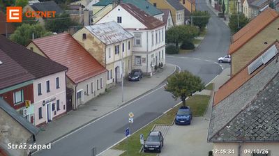


Stříbro occupies the valley of the Mže River in Czechia’s Plzeň Region, amid the rolling uplands of western Bohemia. The town grew around silver mining, an industry reflected in its name and documented by the local Mining Museum. Its compact historic centre includes a Renaissance town hall, while a 16th-century stone bridge crosses the Mže below it. Nearby, the Hracholusky Reservoir on the Mže is a well-known recreation area. Browse other webcams across the Plzeň Region and western Bohemia to place this setting in a wider geographic context.
1 webcam
The river valleys of western Bohemia define much of Plzeň Region, supporting agriculture, linking historic towns and carrying the Mže, Radbuza, Úhlava and Úslava toward Plzeň. In the city, the Mže and Radbuza form the Berounka, while wooded highlands extend west toward the Bohemian Forest and south toward Šumava. Plzeň is the regional centre and the home of Pilsner Urquell: the beer was first brewed here in 1842 and gave its name to the pilsner style. Its centre is marked by the Gothic Cathedral of St Bartholomew and the Great Synagogue. Beyond the city, smaller towns, castles and rural roads give the region a distinct western-Bohemian character. Find related webcams in the surrounding area to build a fuller picture of Plzeň Region.
104 webcams
The terrain of Czechia ranges from fertile lowlands in southern Moravia to mountain ridges along the northern frontier, giving this Central European country a distinctly varied geography. The Vltava runs through Prague before joining the Elbe, while the Krkonoše form part of the border with Poland and include Sněžka, Czechia’s highest mountain. Prague’s historic centre, with Prague Castle and Charles Bridge, reflects the city’s long role as a political and cultural centre. Beyond the capital, Bohemia is known for spa towns and brewing, and Moravia for wine-growing traditions. View additional webcams nearby to better understand how Czechia relates to its Central European surroundings.
1.4K webcams