 Kenosha: Civil War Museum - Promenade/Art Walk
Kenosha is best known within Wisconsin for its Lake Michigan harborfront. The Civil War Museum in HarborPark interprets the conflict through the experiences of people from seven Upper Midwestern states, placing a national story in regional context. The Promenade and Art Walk run beside the harbor, forming part of a public shoreline of paths, lawns and outdoor sculpture shaped by the harbor channel and breakwaters. The red Kenosha North Pier Lighthouse marks the harbor entrance, while the city’s heritage streetcar line circulates between the lakefront and downtown. Here, museums, pedestrian space and Great Lakes maritime infrastructure meet on a compact urban waterfront.
Generated by AI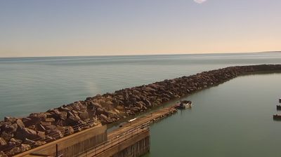








Kenosha straddles the Pike River near its outlet to Lake Michigan in southeastern Wisconsin, and that Great Lakes setting helped establish the city as a port and manufacturing centre. Its waterfront and downtown occupy Lake Michigan’s western shore between Milwaukee and Chicago. Kenosha is closely associated with automobile manufacturing: former Nash and American Motors operations later became part of Chrysler’s local legacy. The 1866 Southport Lighthouse recalls the harbour’s maritime role, while heritage electric streetcars circulate through the centre. Browse other webcams across Wisconsin’s Lake Michigan shore to place Kenosha in a wider Great Lakes context.
2 webcams
Built around Great Lakes shipping, timber, and dairy farming, Wisconsin grew into a Midwestern state with a distinctive industrial and rural identity. Lake Michigan forms its eastern edge, while the Mississippi River marks much of the west; between them lie forests, farms, and thousands of inland lakes. Milwaukee, on Lake Michigan, developed as a major brewing centre, and the state’s dairy tradition remains central to its food culture. In the southwest, the Driftless Area escaped the flattening effects of the last continental glaciation, creating deeply cut river valleys and steep ridges. Find related webcams in the surrounding area to build a fuller picture of Wisconsin.
177 webcams
The Atlantic, Pacific and Gulf coasts define much of the United States — their ports, fisheries and trade routes have long tied the country’s economy to the wider world. Between them, the Rocky Mountains, Great Plains and Mississippi River basin form sharply different regions, from high western ranges to broad agricultural heartlands. Cities carry much of the national story: New York’s Statue of Liberty, a gift from France dedicated in 1886, remains an enduring symbol, while Washington, DC concentrates major federal institutions. Indigenous nations have shaped these lands for millennia, and their living cultures remain essential to the country’s identity. Find related webcams in the surrounding areas to build a fuller picture of the United States.
32K webcams