 Gamprin: Badesee - Rollsportplatz / Pumptrack
Gamprin has served as a rural community in Liechtenstein’s Unterland since the Middle Ages. Its settlements lie on the broad floor of the Rhine Valley, below the Eschnerberg and close to the Rhine, which forms Liechtenstein’s border with Switzerland. The Badesee in the Grossabünt recreation area brings a public waterside space to this small municipality; paths, lawns and planted banks support swimming and time outdoors. Beside it, the Rollsportplatz and pumptrack provide a purpose-built circuit for cyclists, skaters and scooter riders. In nearby Bendern, the parish church of St Peter and St Paul marks one of the municipality’s older centres. Bendern is also associated with the 1699 oath of allegiance following the House of Liechtenstein’s purchase of the Lordship of Schellenberg.
Generated by AI




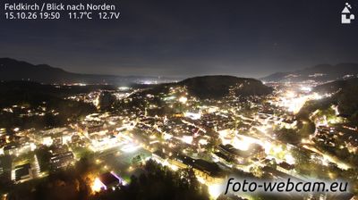



The Rhine Valley defines the setting of Gamprin — its two settlements, Gamprin and Bendern, lie between the Rhine’s broad floodplain and the wooded slopes of the Eschnerberg. This is Liechtenstein’s northern Unterland, close to the Swiss border across the river and linked by local roads to a continuous line of Rhine-side communities. Bendern holds a notable place in the principality’s story: in 1699, the people of the Lordship of Schellenberg swore homage there to Prince Johann Adam Andreas of Liechtenstein after he acquired the lordship. The event is remembered as a step toward the formation of today’s principality. Find related webcams in the Rhine Valley and Unterland to build a fuller picture of Gamprin.
1 webcam
The terrain of Unterland ranges from the level Rhine Valley in its west to the wooded rise of the Eschnerberg in its east, concentrating farms and settlements on the ground between them. This northern part of Liechtenstein includes Ruggell, Schellenberg, Gamprin, Eschen and Mauren, with the Rhine forming the border with Switzerland. The Ruggeller Riet, a protected wetland on the valley floor, preserves an uncommon expanse of reed beds and peatland. Above the plain, the ruins of the castles at Schellenberg recall the area’s medieval settlement history. Its compact communities maintain a distinctly rural counterpoint to Vaduz farther south. Continue with other webcams from the area to see how this part of Liechtenstein’s Rhine Valley connects regionally.
2 webcams
Liechtenstein runs from the Rhine Valley along its western frontier to the Alpine slopes on its eastern side, encompassing a compact stretch of lowland vineyards and high mountain terrain. Wedged between Switzerland and Austria, the principality is one of Europe’s smallest sovereign states, yet its settlements range from the capital, Vaduz, to traditional villages in the Rhine-side plain. Vaduz Castle, the official residence of the Princely Family of Liechtenstein, stands above the capital. Hiking, cycling and winter sports are central to life in the mountains, while the Rhine remains a defining feature of the western border. Discover other points of interest through webcams located across Liechtenstein.
7 webcams