 Ruggell: Hoher Kasten - Kamor - Furgglenfirst
Tucked along the eastern floor of the Rhine Valley, Ruggell is a place whose character is shaped by flat farmland beneath the limestone ridges of the Alpstein. Liechtenstein’s northernmost municipality lies close to the Rhine, with Swiss mountains rising across the valley. Hoher Kasten, Kamor and Furgglenfirst belong to this Appenzell mountain country; Hoher Kasten is reached by cable car from Brülisau and is a well-known Alpstein summit. Within Ruggell, the protected Ruggeller Riet preserves part of the Rhine Valley’s wetland terrain, while the parish church of St Fridolin provides a local architectural focal point. Fields, drainage channels and scattered farm buildings give the settlement an open valley character unlike the steeper communities farther south in Liechtenstein.
Generated by AI


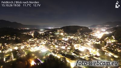


Among the municipalities of Liechtenstein’s Unterland, Ruggell stands out for its position between the Rhine and the protected wetlands of the Ruggeller Riet. This northern community occupies the broad Rhine Valley, close to the Austrian and Swiss borders, while the wooded Eschnerberg rises to its south. The Ruggeller Riet reserve safeguards reed beds, wet meadows and shallow pools, providing an important contrast to the cultivated valley floor. In the village centre, the Parish Church of St Fridolin is a recognisable part of local life. View additional webcams nearby to better understand how Ruggell and the Rhine Valley relate to their surroundings.
1 webcam
The terrain of Unterland ranges from the level Rhine Valley in its west to the wooded rise of the Eschnerberg in its east, concentrating farms and settlements on the ground between them. This northern part of Liechtenstein includes Ruggell, Schellenberg, Gamprin, Eschen and Mauren, with the Rhine forming the border with Switzerland. The Ruggeller Riet, a protected wetland on the valley floor, preserves an uncommon expanse of reed beds and peatland. Above the plain, the ruins of the castles at Schellenberg recall the area’s medieval settlement history. Its compact communities maintain a distinctly rural counterpoint to Vaduz farther south. Continue with other webcams from the area to see how this part of Liechtenstein’s Rhine Valley connects regionally.
2 webcams
Liechtenstein runs from the Rhine Valley along its western frontier to the Alpine slopes on its eastern side, encompassing a compact stretch of lowland vineyards and high mountain terrain. Wedged between Switzerland and Austria, the principality is one of Europe’s smallest sovereign states, yet its settlements range from the capital, Vaduz, to traditional villages in the Rhine-side plain. Vaduz Castle, the official residence of the Princely Family of Liechtenstein, stands above the capital. Hiking, cycling and winter sports are central to life in the mountains, while the Rhine remains a defining feature of the western border. Discover other points of interest through webcams located across Liechtenstein.
8 webcams