 Stity: Náměstí ve Štítech
Štíty combines the compact rhythm of a small town with the open terrain of the foothills in a way that reflects its position on the Březná River in north-eastern Czechia. Set in the Šumperk District of the Olomouc Region, it serves as a practical local centre rather than a resort town. Its central square is defined by closely spaced, mostly two-storey buildings, where shops, services and traffic share the same compact core. The Březná continues through the town before joining the Morava River farther south, while the rolling surroundings mark a transition towards the higher ground of northern Moravia. Štíty is shaped by everyday regional life: a modest civic centre, connecting roads and an urban fabric whose scale remains easy to read.
Generated by AI
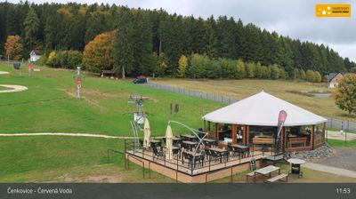




Tucked into the rolling uplands below the Orlické Mountains, Štíty is a town whose character is shaped by the Březná River and its position close to the historic Bohemian–Moravian border. In the northwestern corner of the Olomouc Region, it serves a rural area of fields, woodland and small settlements rather than functioning as an urban centre. The parish Church of the Assumption of the Virgin Mary and the town square are key historic points of reference. The surrounding hills support local winter sports and outdoor recreation, while Štíty itself retains the scale of a small Czech borderland community. Continue through nearby webcams to explore different parts of the Olomouc Region.
1 webcam
Olomouc Region occupies a varied inland belt in eastern Czechia. Its terrain moves from the fertile Haná lowlands around Olomouc to the forested Jeseníky Mountains in the north, where Praděd reaches 1,491 metres, the highest summit in Moravia and Czech Silesia. The Morava River provides a north–south thread through the region and has long supported settlement and farming. Olomouc, the historic capital of Moravia, retains a notable baroque core; its Holy Trinity Column is inscribed on UNESCO’s World Heritage List. Smaller towns, agricultural country and mountain communities give the region a distinctly changing character. Browse other webcams across Olomouc Region to place this setting in a wider geographic context.
81 webcams
The terrain of Czechia ranges from fertile lowlands in southern Moravia to mountain ridges along the northern frontier, giving this Central European country a distinctly varied geography. The Vltava runs through Prague before joining the Elbe, while the Krkonoše form part of the border with Poland and include Sněžka, Czechia’s highest mountain. Prague’s historic centre, with Prague Castle and Charles Bridge, reflects the city’s long role as a political and cultural centre. Beyond the capital, Bohemia is known for spa towns and brewing, and Moravia for wine-growing traditions. View additional webcams nearby to better understand how Czechia relates to its Central European surroundings.
1.4K webcams